 in Upper Rhine & Pfalz")
The Upper Rhine is the section of the river Rhine between Basel (Switzerland) and Bingen am Rhein (Germany) (https://en.wikipedia.org/wiki/Upper_Rhine). The Northern part of this section belongs entirely to Germany, more specifically between the districts of Karlsruhe, Mannheim, Mainz, Wiesbaden, Rüdesheim am Rhein and Bingen am Rhein.
On the other hand, the area between the Upper Rhine and the French border is called “Pfalz” in German, that is the Palatinate in English (Palatinate (region) – Wikipedia).
This page aims to focus on different places on both side of the river Rhine, or not far from it, where it is possible to do trail-running and/or hiking, following marked tracks/routes. You can click on the link below the map to view it in larger dimensions.
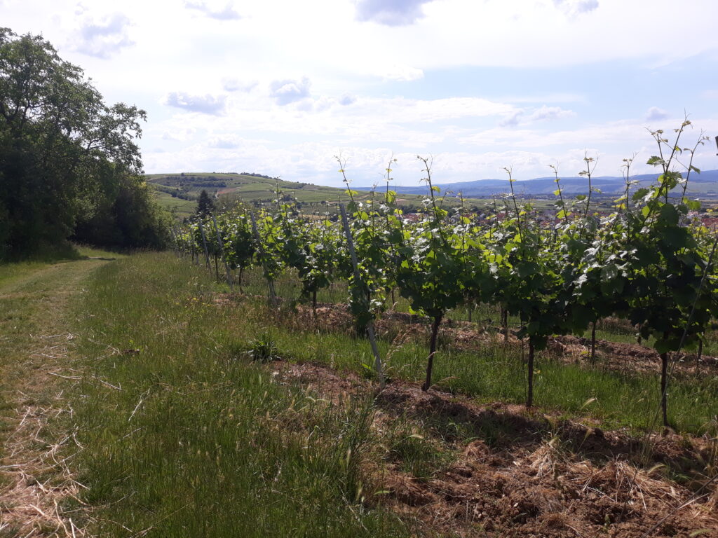
Ingelheim am Rhein
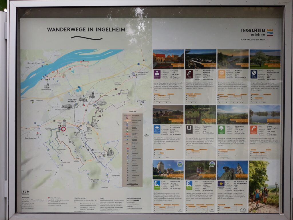
A possible starting point is the Bismarckturm in Ingelheim am Rhein. There are 11 well-marked routes, which can be easily combined to create longer loops, if you want:
- Kaiserpfalz Weg: 7,9 km (38 m D+)
- WeinMeile Weg: 3,7 km (104 m D+)
- Ingelheimer Auslese Weg: 12,4 km (261 m D+)
- Selztal Runde: 6,3 km (58 m D+)
- Panorama Weg: 6,8 km (155 m D+)
- Rundweg Westerberg: 6,7 km (96 m D+)
- Waldblick Runde: 4,5 km (58 m D+)
- Erlebnispfad Jungaue: 8,5 km (14 m D+)
- Hiwwelttour Bismarckturm: 10,3 km (152 m D+)
- Hiwweltour Westerberg: 11,3 km (145 m D+)
- Rheinhessischer Jacobsweg: 9,8 km (120 m D+)
More information and details about some of these hiking routes can be found at the following website: Wandern in Rheinhessen.
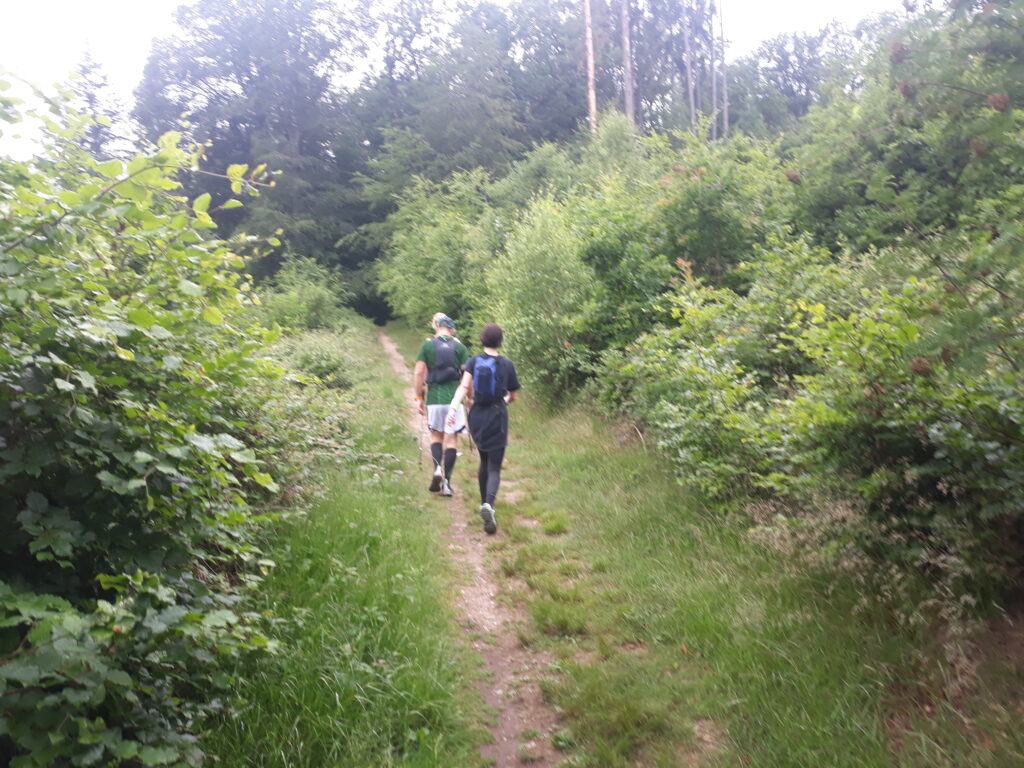
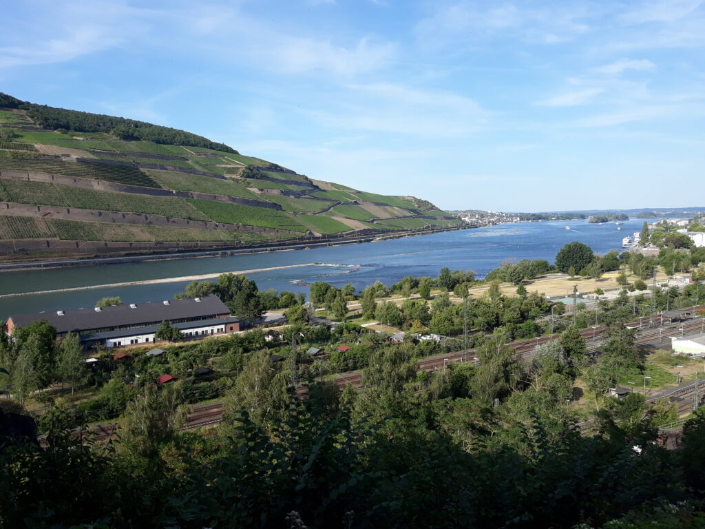
Rheinsteig from Wiesbaden-Biebrich to Rüdesheim am Rhein
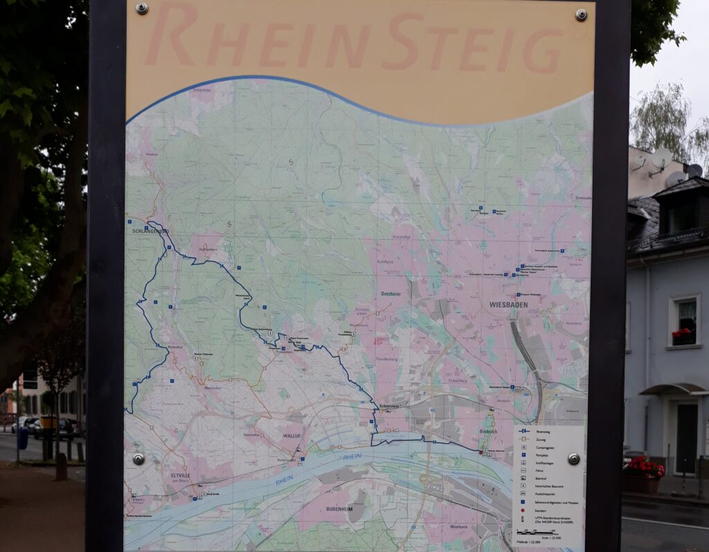
The Rheinsteig is a hiking trail following a mainly elevated path along the east bank of the Rhine River in Germany. The Rheinsteig passes through woodlands and vineyards, and has challenging ascents and descents. In 2020, I covered the complete Rheinsteig in five ultra-stages: Rheinsteig South-North in five stages | EmigranTrailer.
The section that connects Wiesbaden-Biebrich to Rüdesheim am Rhein belongs to the Upper-Rhine:
- Rheinsteig (Stage 1): 57,3 km (1472 m D+)
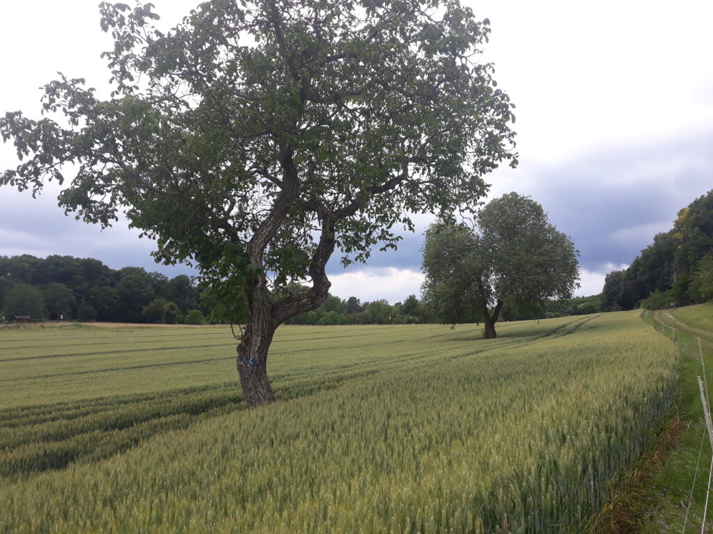

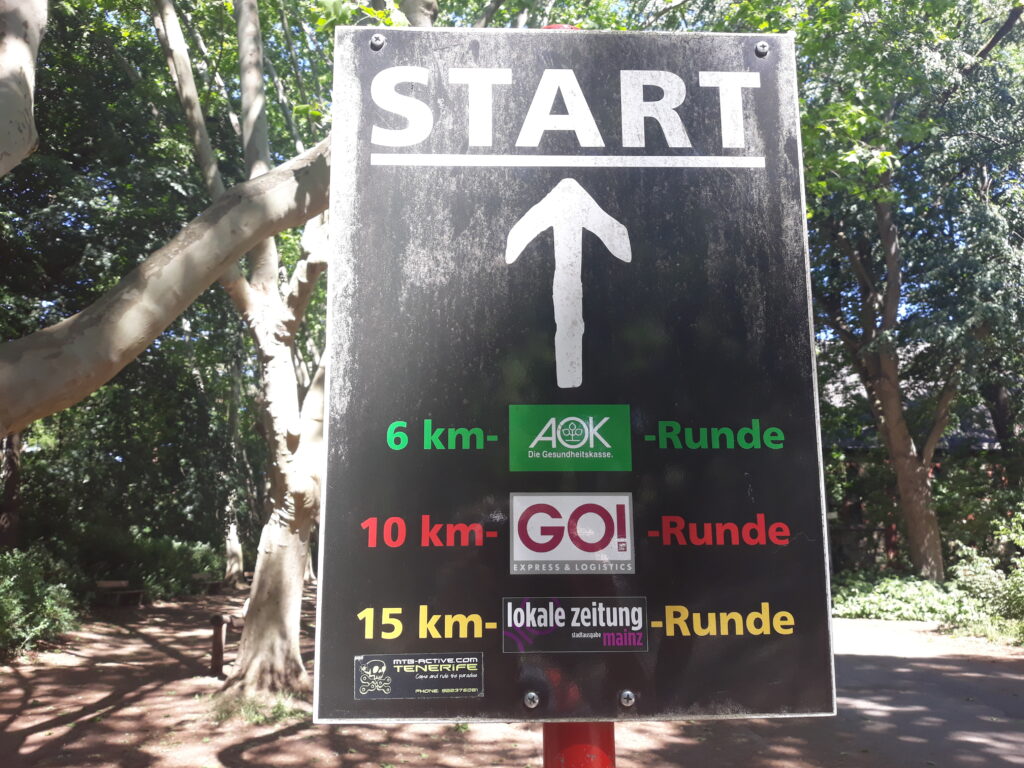
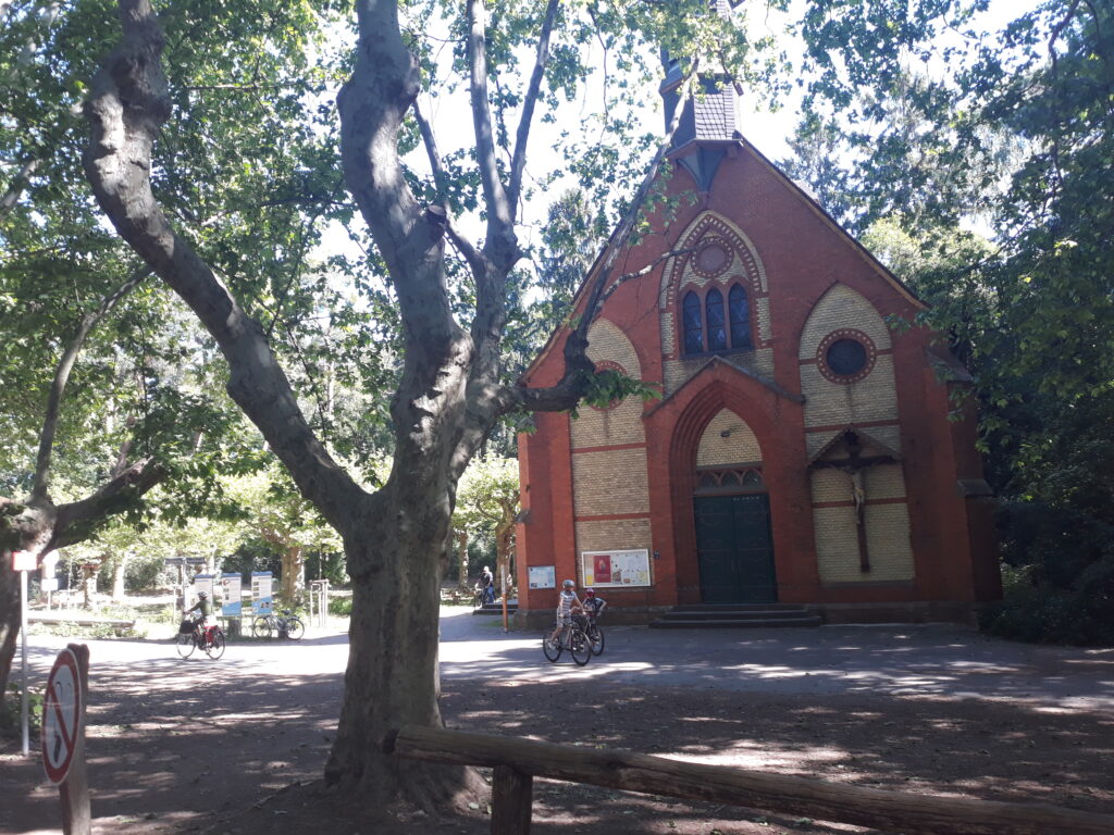
Mainz-Gonsenheim
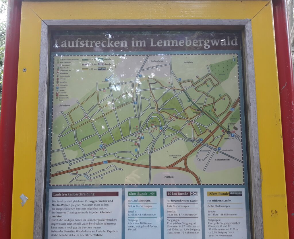
The starting point is at the entrance of the Lennebergwald in Mainz Gonsenheim. There are 3 well-marked routes (green, red and yellow), which can be easily combined to create longer loops, if you want:
- Green-6 Km Runde: 6,16 km (48 m D+)
- Red-10 Km Runde: 10,16 km (87 m D+)
- Yellow-15 Km Runde: 15,78 km (148 m D+)
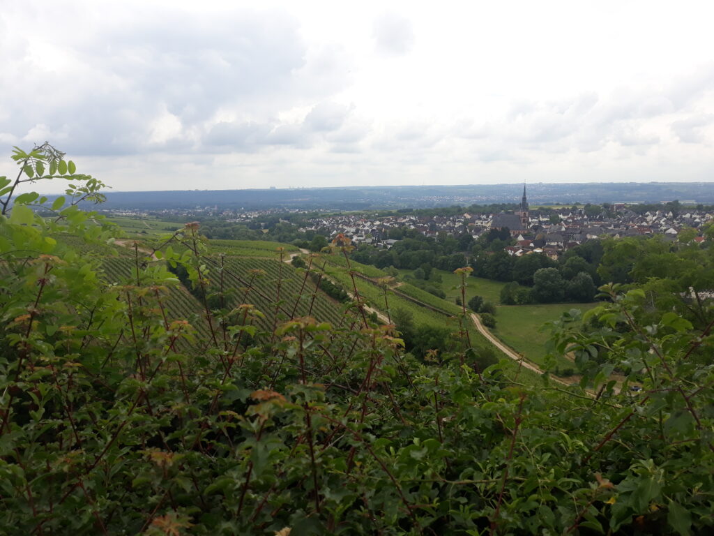
Eltville am Rhein
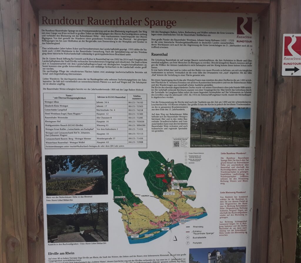
A possible starting point is at the church of Sankt-Anthonius Eremita in Eltville am Rhein. The route is marked with the typical sign of the Rheinsteig, but with the red background.
Rundtour Rauenthaler Spange: 8 km
Oestrich-Winkel
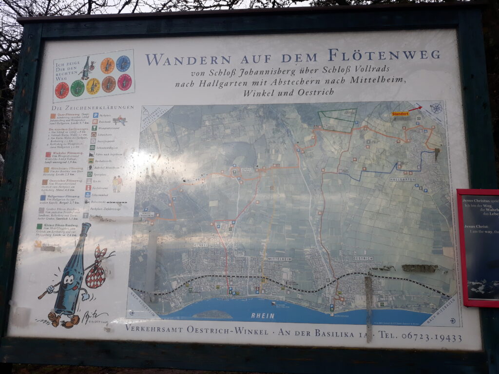
A possible starting point is at the Rheingausport shop in the center of Oestrich (rheingausport.de), where you can talk and ask about all the tracks and routes in the surroundings with Marcus.
He is one of the best expert in the area and also creator of some interesting loops between the wineyards and the mountains, like the Tour Honigberg Rheingausport Team Challenge Honigberg | EmigranTrailer.
Another route is the Flötenweg, where you can combine easily many of them to create longer loops, if you want:
- Quer Flötenweg: 9,7 km
- Winkeler Flötenweg: 2,9 km
- Mittelheimer Flötenweg: 2,5 km
- Ostricher Flötenweg: 4,0 km
- Hallgartner Flötenweg: 2,7 km
- Größer Flöten Rundweg: 3,3 km
- Kleiner Flöten Rundweg: 2,6 km
Bingen am Rhein
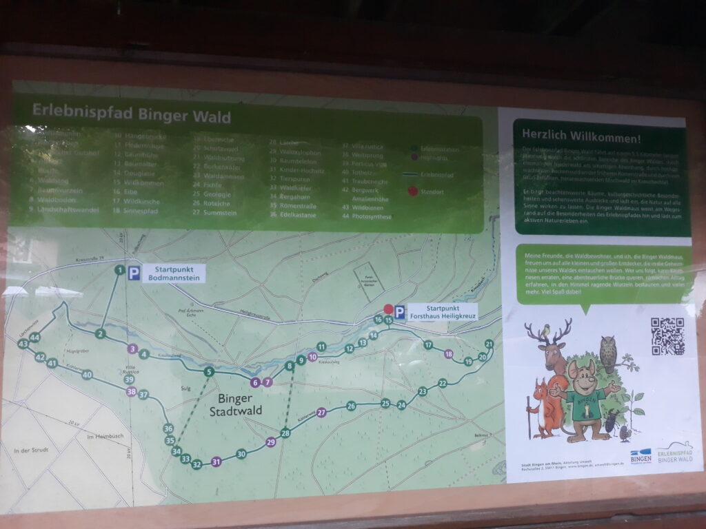
This is a good starting point to discover the many other trail in the area of Bingen:
- Erlebnispfad Binger Wald: 4,5 km
More information and details about some this short route can be found at the following website: Erlebnispfad Binger Wald | Erlebnispfad Binger Wald (erlebnispfad-bingen.de)
Dannenfels
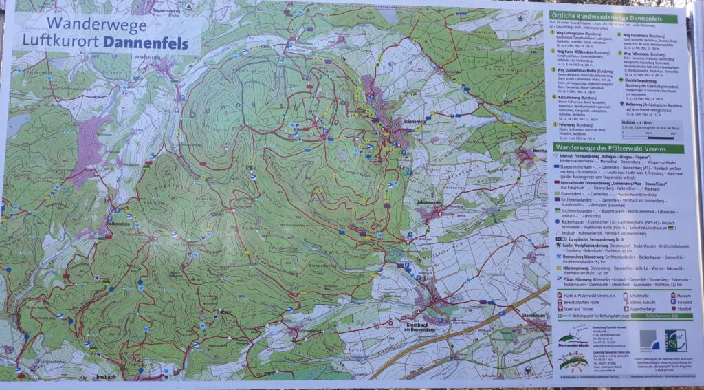
A possible starting point is in Dannenfels, just at the bottom of the Donnersberg. There are a lot of well-marked routes, which can be easily combined to create longer loops, if you want:
- (1) Weg Ludwigsturm: 6,5 km (256 m D+)
- (2) Weg Ruine Wildenstein: 8 km (199 m D+)
- (3) Weg Dannenfelser Mühle: 7.5 km (192 m D+)
- (4) Kastanienweg: 14,5 km (395 m D+)
- (5) Felsenweg: 5 km (233 m D+)
- (6) Weg Bastenhaus: 11 km (260 m D+)
- (7) Weg Falkenstein: 17,5 km (487 m D+)
- Kleeblattwanderweg: 13,5 km (300 m D+)
- Keltenweg: 5 km (112 m D+)
- Großer Westpfalzwanderweg: 95 km
- Donnersberg Wanderweg: 63 km
- Nibelungenweg: 140 km
- Pfälzer Höhenweg: 112 km
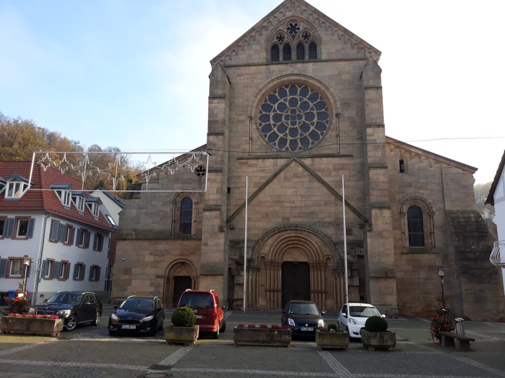
Otterberg
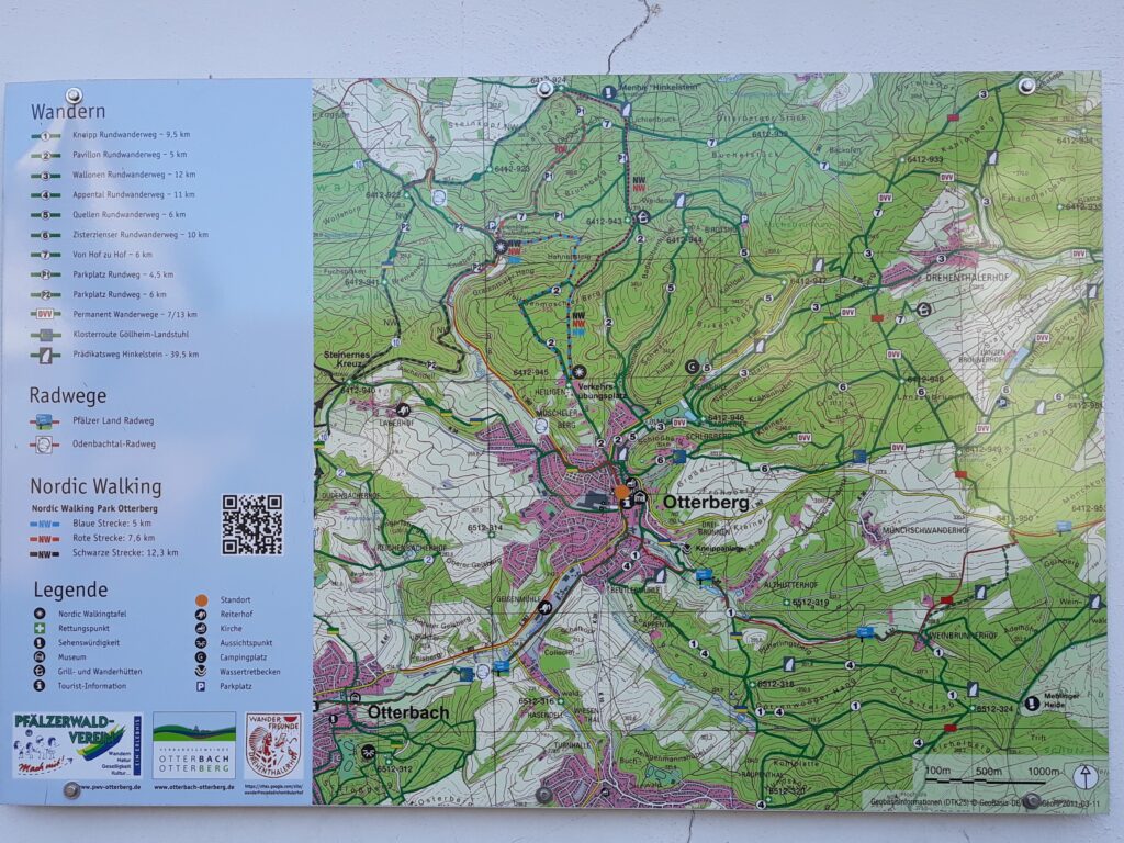
A possible starting point is the main square in front of the church in Otterberg. There are several hiking routes, which can be easily combined to create longer loops, if you want:
- (1) Kneipp Rundwanderweg: 9,5 km
- (2) Pavillon Rundwanderweg: 5 km
- (3) Wallonen Rundwanderweg: 12 km
- (4) Appental Rundwanderweg: 11 km
- (5) Quellen Rundwanderweg: 6 km
- (6) Zisterzienser Rundwanderweg: 10 km
- (7) Von Hof zu Hof: 6 km
However, for a longer complete loop from Otterberg to Otterberg, I would recommend the following:
- Hinkelsteigweg: 40,21 km (749 m D+)
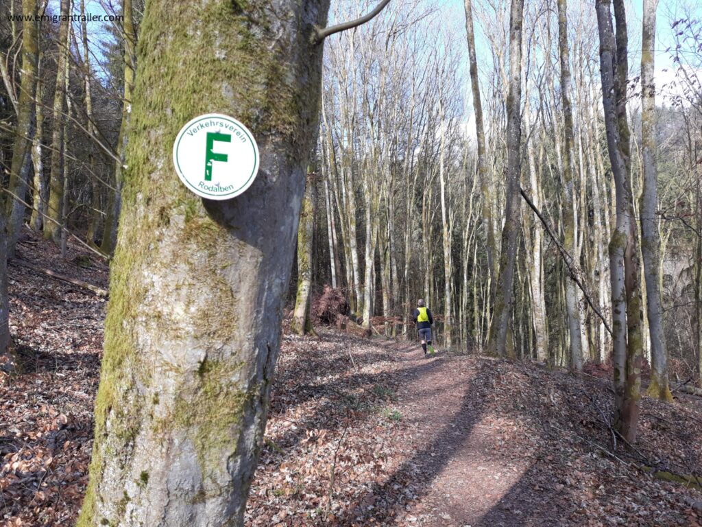
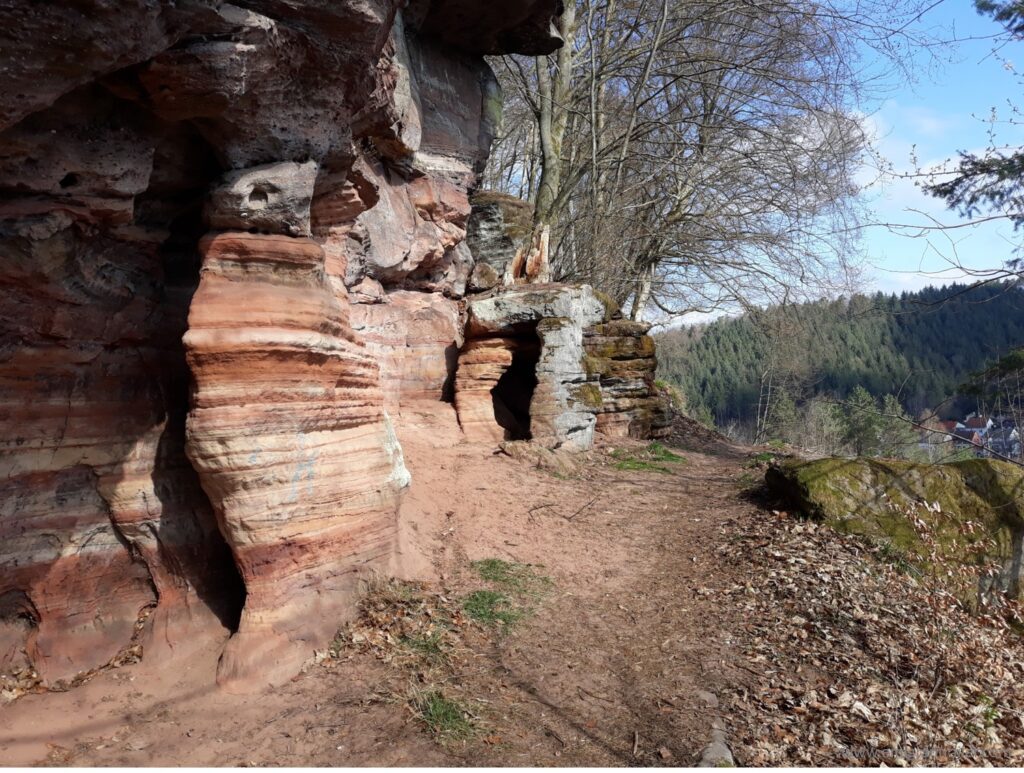
Rodalben
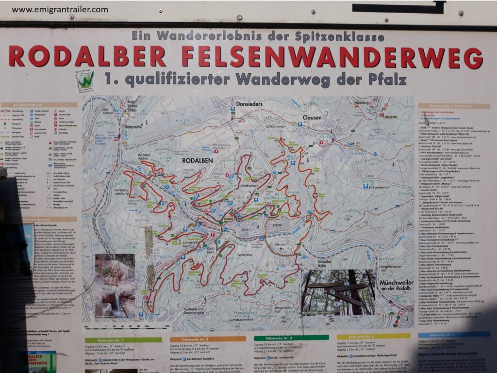
It is a wonderful circular hiking trail of approx. 47 km in length, leading around the city of Rodalben (Felsenwanderweg Rodalben – Felsenwanderweg).
The loop can be done in three stages or in a single stage like I did in 2021:
- Rodalber Felsenwanderwege: 47,34 km (860 m D+)
- My GPS Route: https://www.suunto.com/move/andreadefilippo70/60674eae2226151746aee882
- My GPX Track: https://api.sports-tracker.com/apiserver/v2/routes/export/eTlvZmcxVUpBMkpqZTI5NjY0bStldWVwc0lmaWdlTis4NFhiZlhaaUwrST0=?brand=SUUNTOAPP
Final Remarks
If you have any specific comment or request on these routes or others, do not hesitate to contact me or comment below. I will constantly update this page as soon as I explore new tracks.
Related projects and articles
Other ideas to explore trails and hiking routes in Germany at the following link: Trail Running (and hiking) to explore Germany | EmigranTrailer
Enjoy your passions!
Andrea De Filippo
Original post in english language. For other languages, please open with a web browser (i.e. Chrome) and apply the automatic translation.


Nice Tours
Thanks. There are other 1000 options around. 🙂