
Mount Kilimanjaro is certainly one of the most fascinating and well-known mountains in the world.
It is also the highest mountain in Africa and the highest single free-standing mountain above sea level in the world: 5,895 m (19,341 ft) above sea level and about 4,900 m (16,100 ft) above its plateau base (Mount Kilimanjaro – Wikipedia).
It is a very popular destination for long treks, given the enormous range of uphill roads it offers, especially on the Tanzanian side.
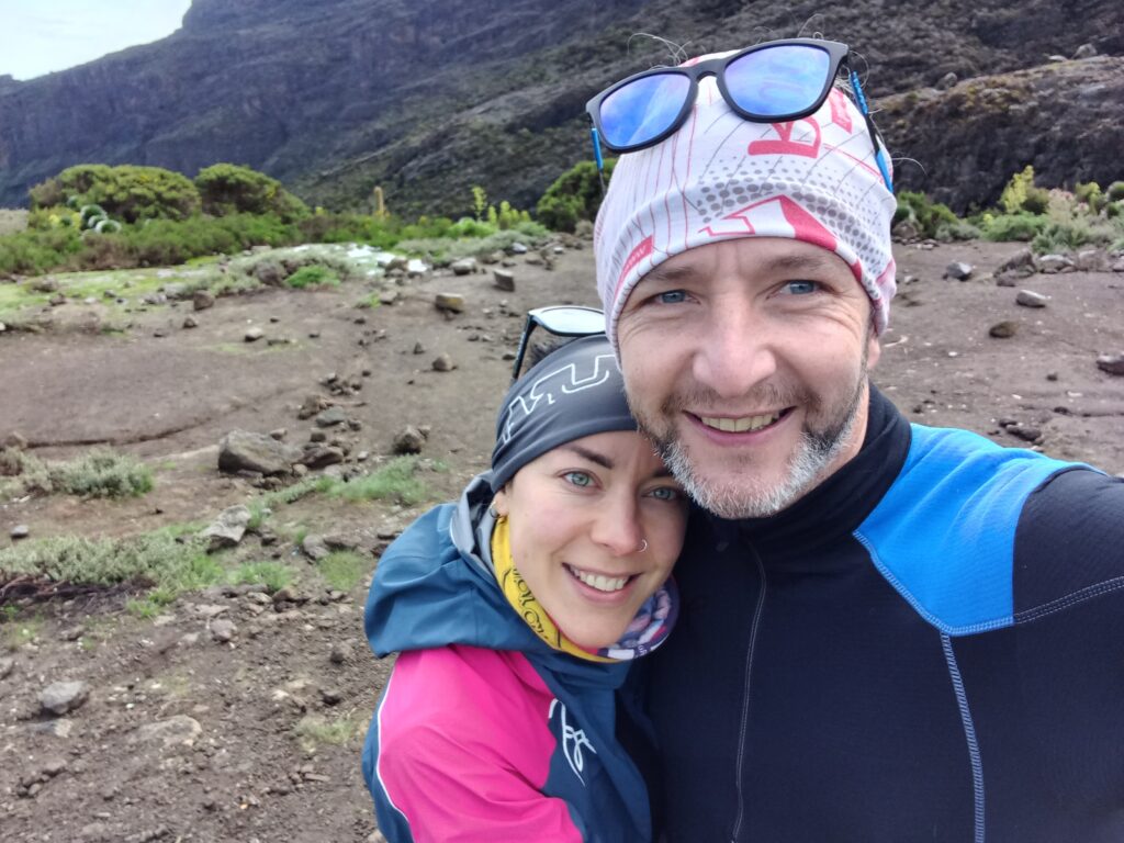
For the Christmas holidays, Agnese and I decided to treat ourselves to this experience, letting ourselves be guided to discover the Machame route along the way up and then down towards the Mweka Gate.
Before going into the details of the individual days, with information, GPX tracks and photos, I leave some general indications and suggestions for anyone wishing to repeat the same experience. I leave other details and suggestions next to the description of the photos.
Kilimanjaro trekking: some info and suggestions
Mount Kilimanjaro: We are all used to calling him that. But it is essentially a mistake, as the local guides immediately explained to us. Kilimanjaro is the region where this large mountain is located, consisting of three main volcanic cones: Kibo, Mawenzi and Shira. The main and highest crater is Kibo, with two peaks: Stella Point (5749m) and Uhuru Peak (5895m). So, essentially, the mountain you climb is Kibo.
Duration: there are different options. Namely, 6 days, 7 days, 8 days and so on. We opted for 6 days. In retrospect, for better acclimatization especially above 5000m, I believe that the most suitable option is 7 days. Obviously, everything depends on physical preparation, habituation to high altitudes and the physical condition of the moment. We are generally very prepared, but we started the trek coming from a very intense and stressful period between work and private life. It should not be underestimated before starting.
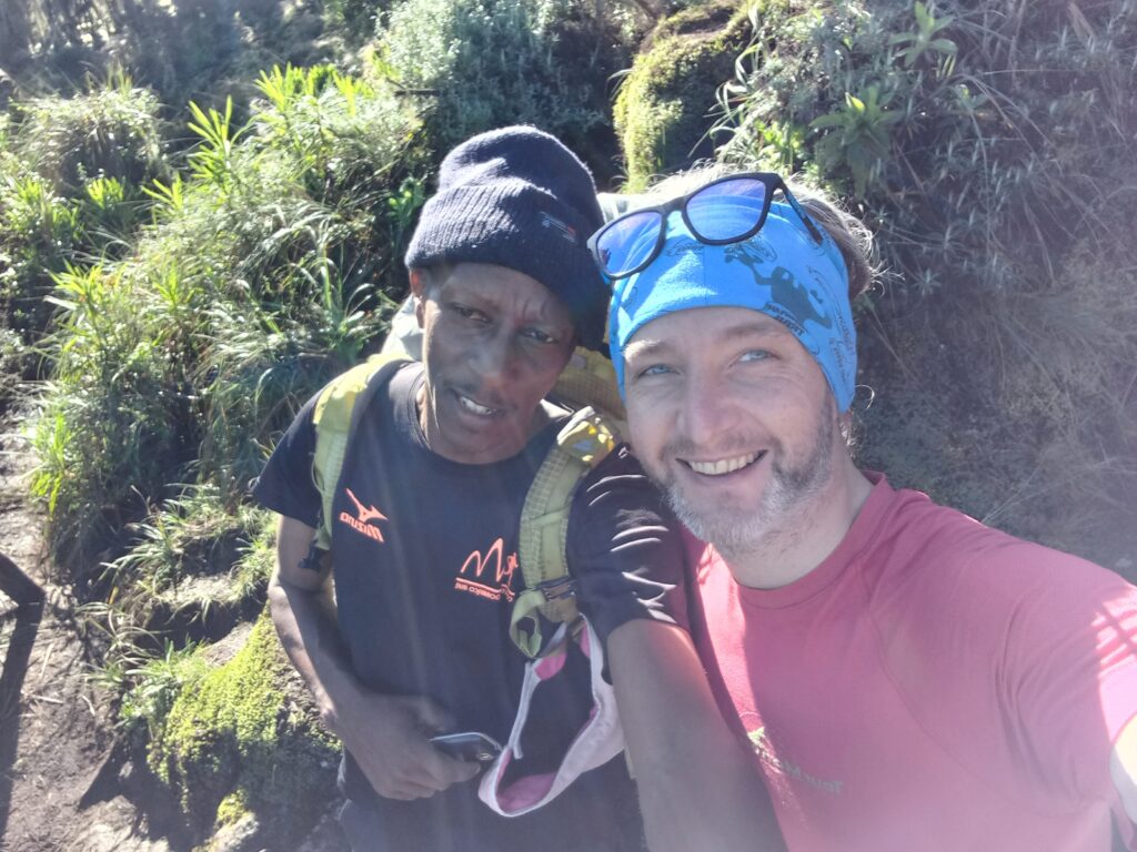
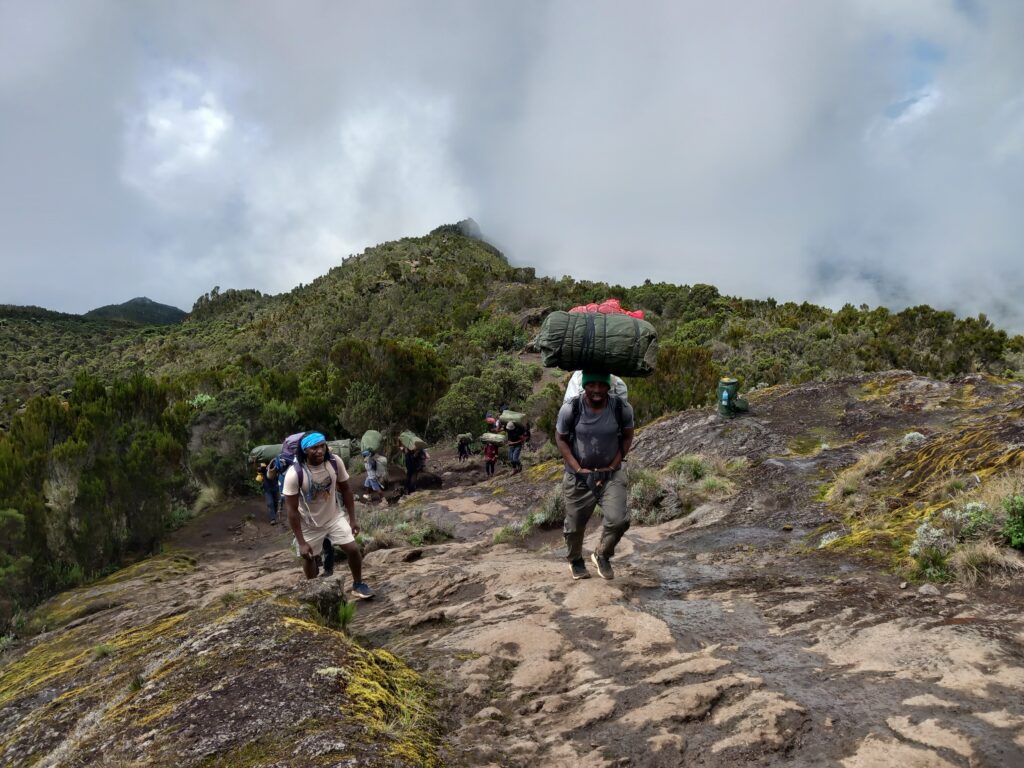
Guide and porters: it is mandatory to enter the park with a certified local guide. It cannot be done individually (unless special permission is granted). The guide then chooses the team of porters and a possible second guide. In our case we had two guides (Jimmy & Duncan) and 10 porters. Honestly, we are not used to having support, but we then realized that it was necessary for both water, food and accomodation. However, due to our nature, we have always carried our backpacks between 8 and 10 kilos, from the first to the last metre.
Water: there are no sources of drinking water. But the whole mountain is full of streams and springs from which to draw water and then boil it or sterilize it with tablets. The only point where there is no water is between Karanga Camp and Barafu Camp. So, no shower expected for several days! Bring wet and above all biodegradable wipes. Also keep in mind that it is forbidden to climb with plastic bottles.
Food: the guides and porters take care of it directly, listening to customers’ requests. An important aspect is fruit such as watermelon, pineapple, mango which provide an additional contribution of water.
Hydration: it is recommended to drink at least 4 liters of water a day, so that you can be prepared for the sudden change in altitude. It’s not easy to drink that much (especially if your stomach is upset), but it’s really essential. And here we could understand the importance of the porters who often went up and down to collect water and then boil it.
Weather: obviously depends on when you go. Between the end of December (in our case) and the end of February is a good period as it is just after the rainy season, but not yet in the hot and dry season. During the day the weather can change often and quickly, so everyone needs to be prepared. Later in the text, with some photos, I give some more details.
Language: Guides are generally chosen by agencies capable of communicating in the client’s language. In general, everyone speaks English very well. During the day you will often hear Swaili expressions such as Hakuna Matata (no problem), Jambo (Hello), Pole Pole (slowly), Mambo (how are you), Poa Poa (cool).
Cost: let’s say it depends on the agency you choose (and there are many in Tanzania). However, we can reasonably estimate a cost of €500 per day just for the trekking (flight and tips are excluded).
Tipping: it is a fundamental aspect for guides and porters. Since it is a tip, there is no precise amount. But keep in mind that porters are paid between 5 and 10 dollars a day (depending on their role) and that guides are certainly above 10 dollars a day. They typically expect to “double” their daily income through the customer’s tip. We tried to be “democratic” and the two of us left about 6 dollars in tips per day. Certainly, the choice is individual and depends on the treatment received.
Currency: you can use both dollars and euros.
Flies and mosquitoes: theoretically it is said that there are none. The reality is that both on the first and last day, while crossing the rainforest, some mosquitoes can bite you. For example, I was stung three times in the first few meters of the climb. So, I still recommend having some repellent with you and something to soothe the itching.
Now, I’ll write some more detailed aspects of the climb and what was necessary, day by day.
Kilimanjaro trekking_Day 1: Machame Gate – Machame Camp
- Distance: 11 km
- Elevation gain: 1187 m
- Elevation loss: 9 m
- Highest point: 3023 m
- Date: 21/12/2023
- Start time: 1:07 p.m.
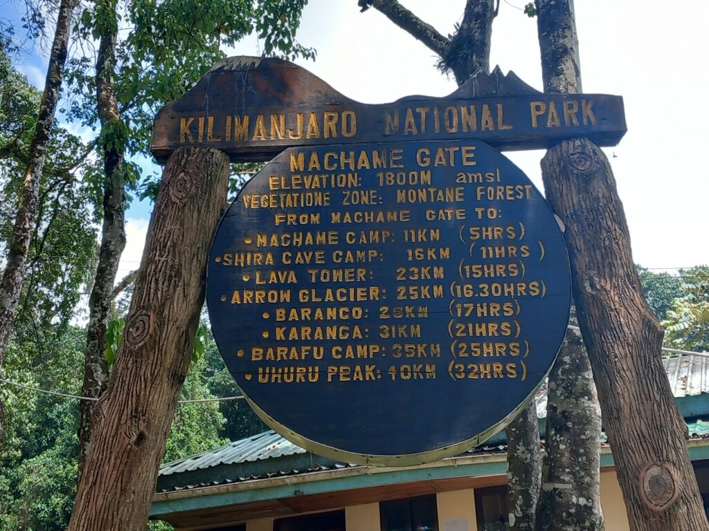
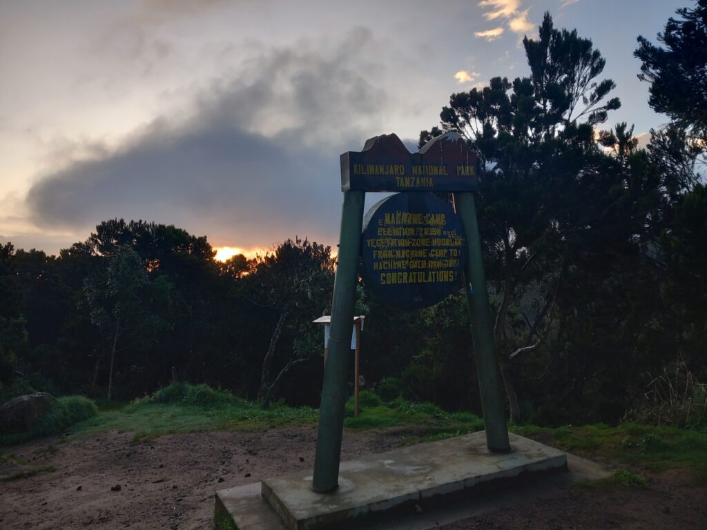
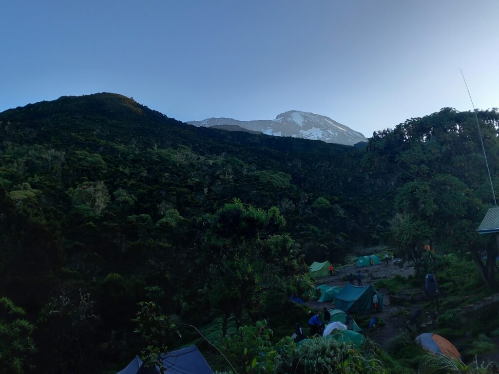
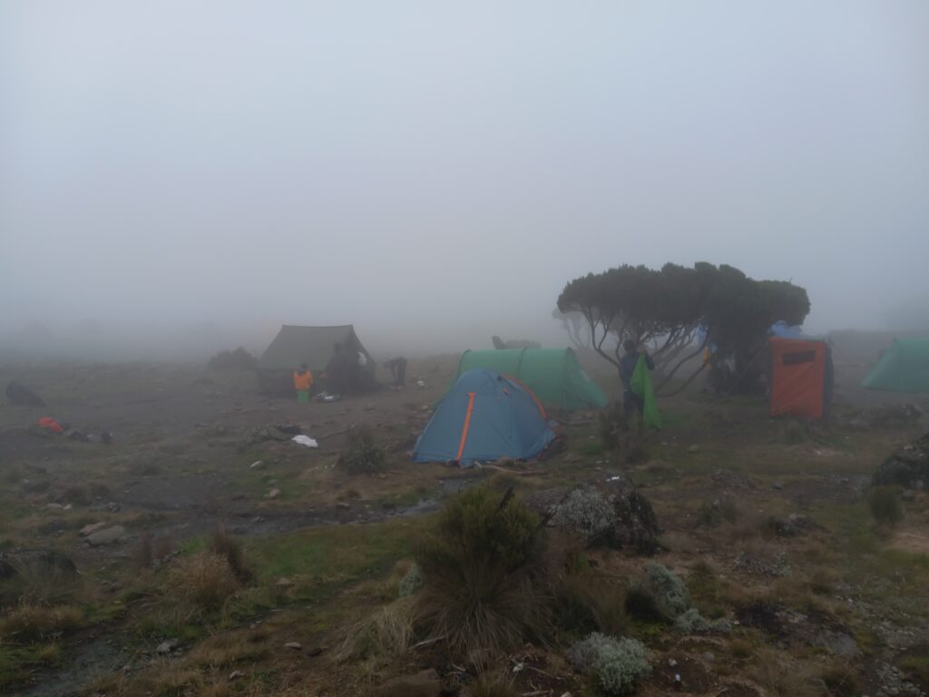
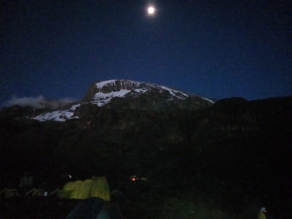
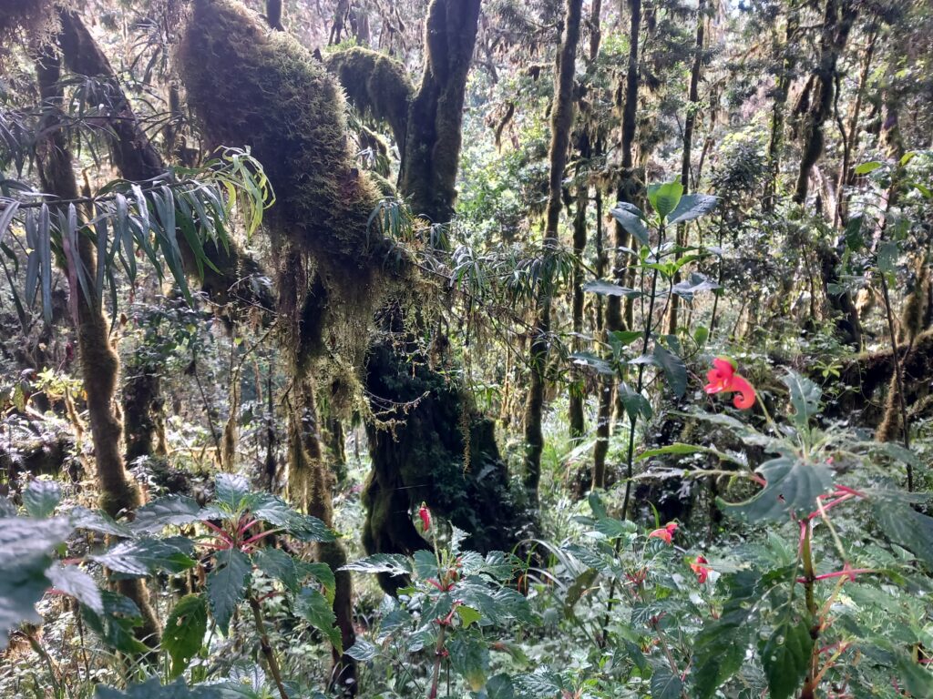
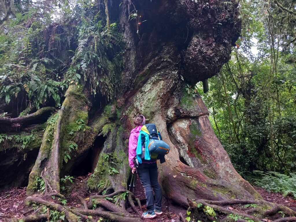
Once we had completed all the paperwork and had lunch, we left from the Machame Gate and began our trek entering the rainforest. The temperature was plenty warm so we set out in light clothing.
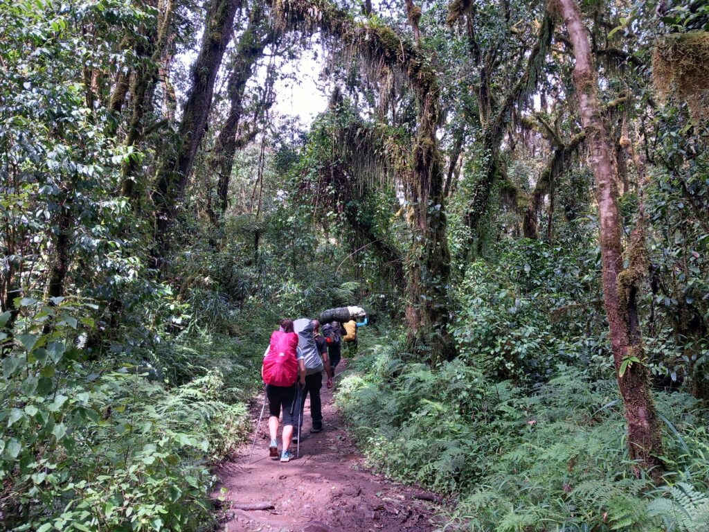
We kept a very slow pace (for our usual rhythms) but were aware of having to gradually acclimatise. Halfway up the climb and mid-afternoon the first rain arrived and accompanied us until we arrived at Machame Camp, just above 3000m.
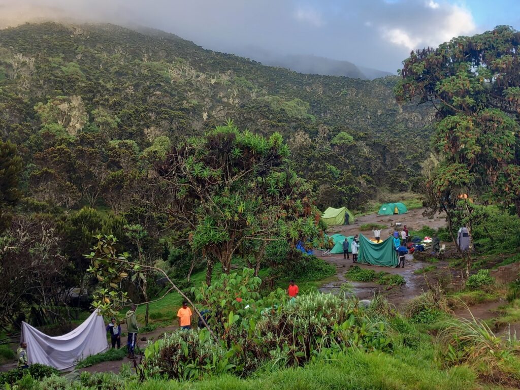
The rain then calmed down, but left a lot of mud around the tents and definitely contributed to lowering the outside temperature.
Only at sunset did the clouds begin to give way to the blue sky. This will be a situation that will be repeated in the following days.
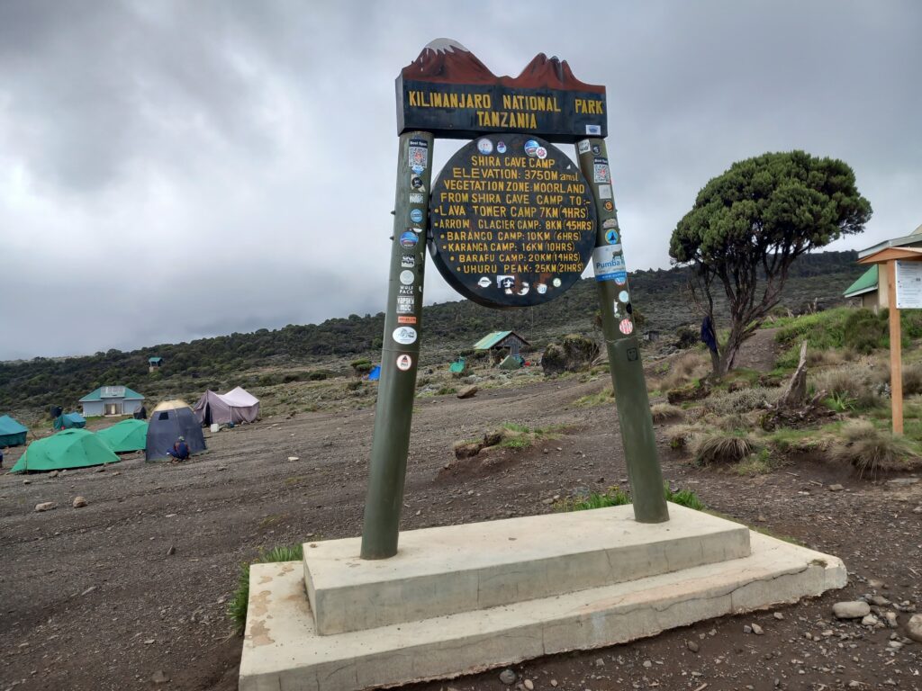
Kilimanjaro trekking_Day 2: Machame Camp – Shira Cave Camp
- Distance: 5 km
- Elevation gain: 873 m
- Elevation loss: 72 m
- Highest point: 3894 m
- Date: 22/12/2023
- Start time: 08:12 a.m.
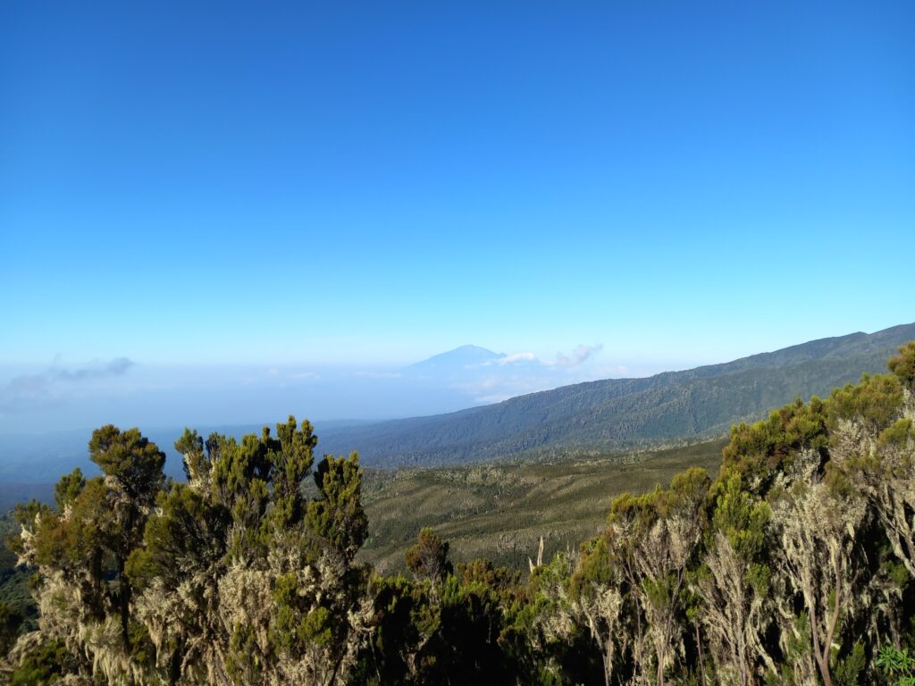
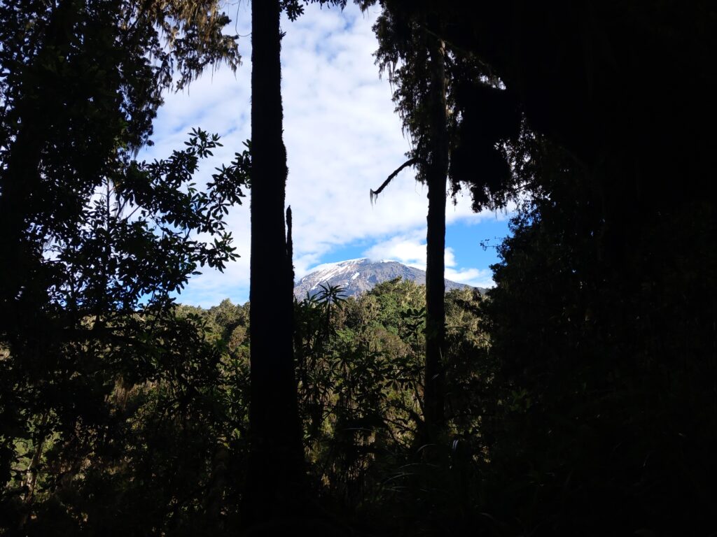
In the morning we woke up to a beautiful blue sky which allowed us to see Kibo for the first time.
The estimated distance to reach Shira Cave Camp was just over 5 km. Not a lot but with an initial climb that was decidedly steeper than the previous day.
During the morning the weather started to change again with several clouds rising quickly from below.
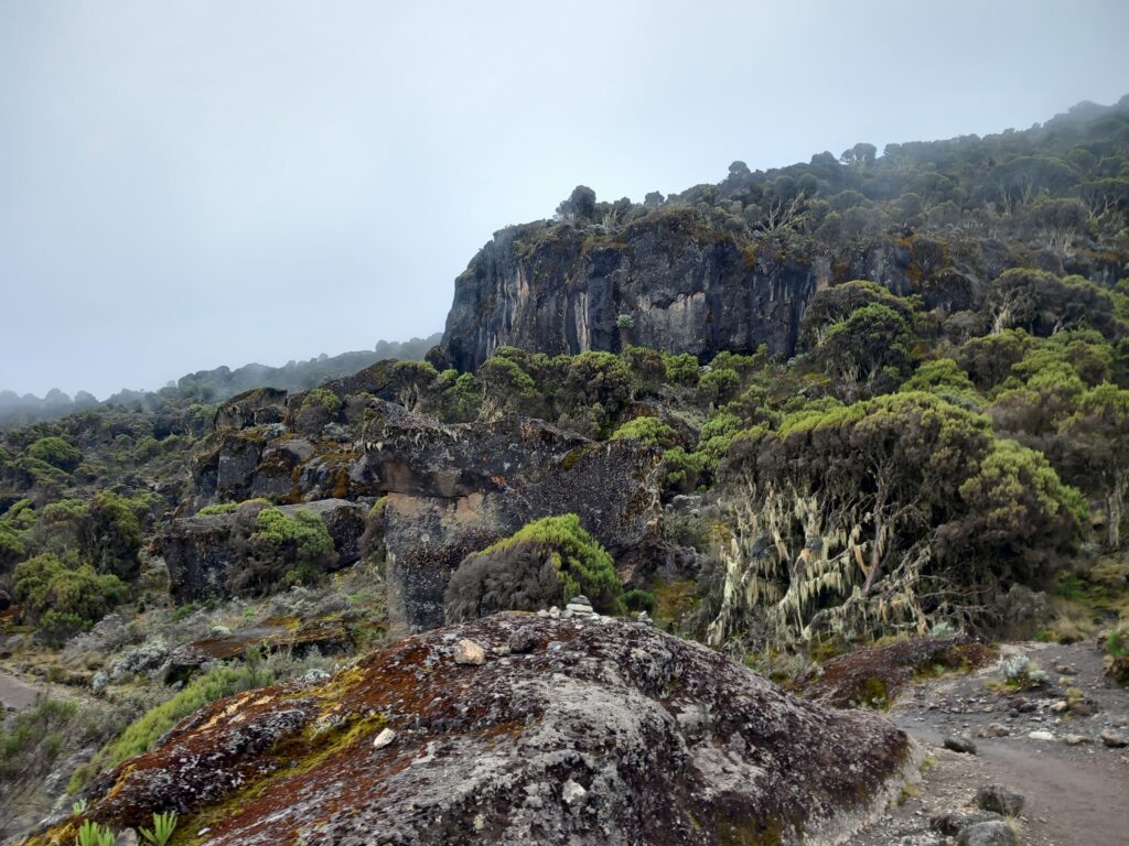
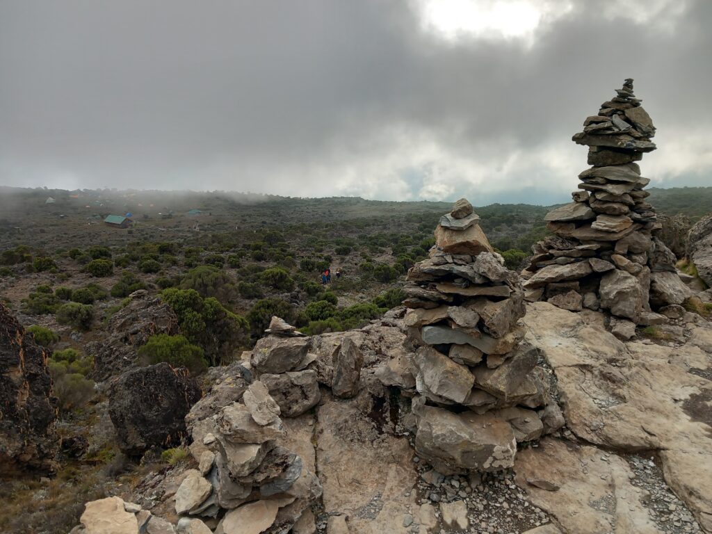
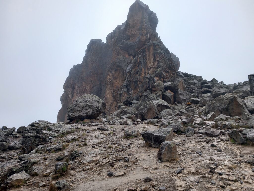
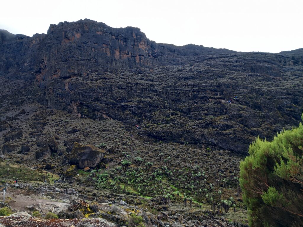
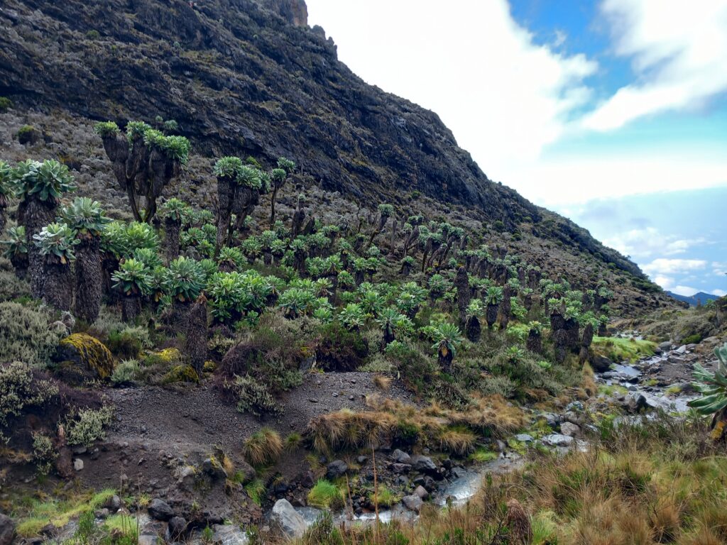
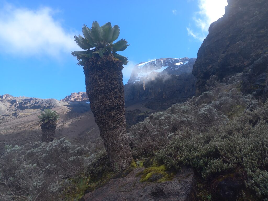
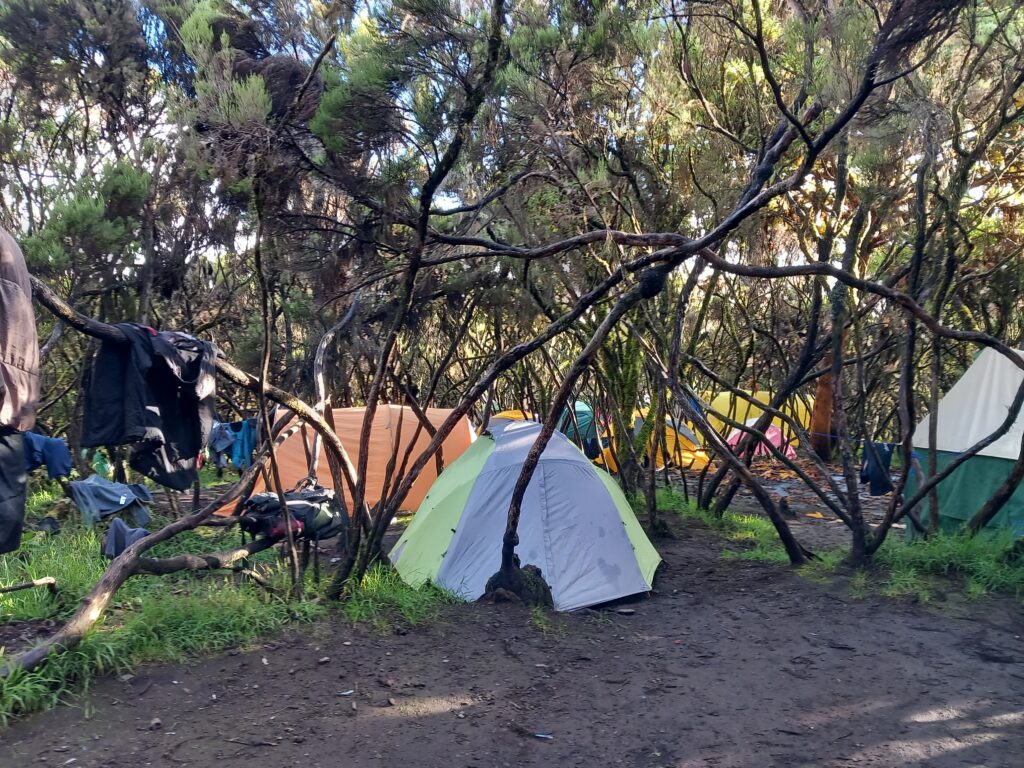
The vegetation had obviously changed above 3000 m, abandoning the greenery and tall trees of the rainforest, to give way to shorter plants and different rock formations.
We then arrived at Shira Cave Camp, around 3800 m, just before fog and clouds took over.
During the climb we already noticed some customers and some porters having difficulty with the altitude. Surely the night at Schira Cave Camp would have been the first important test to understand the situation for the days to come, where we would mostly have been above 4000m.
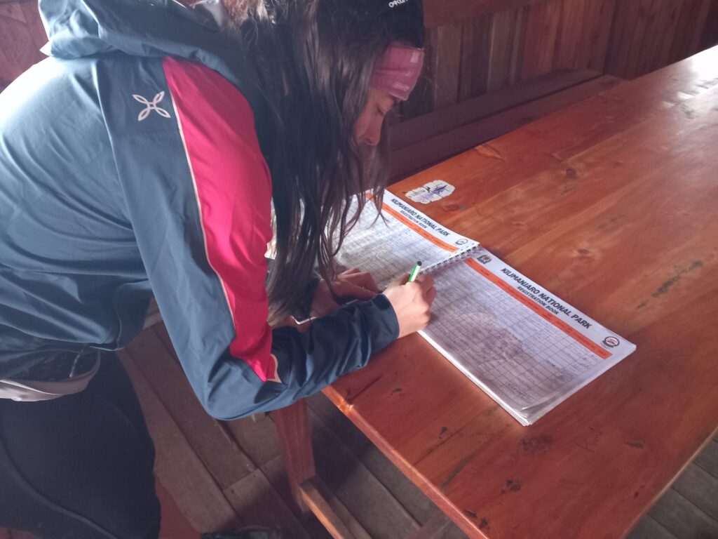
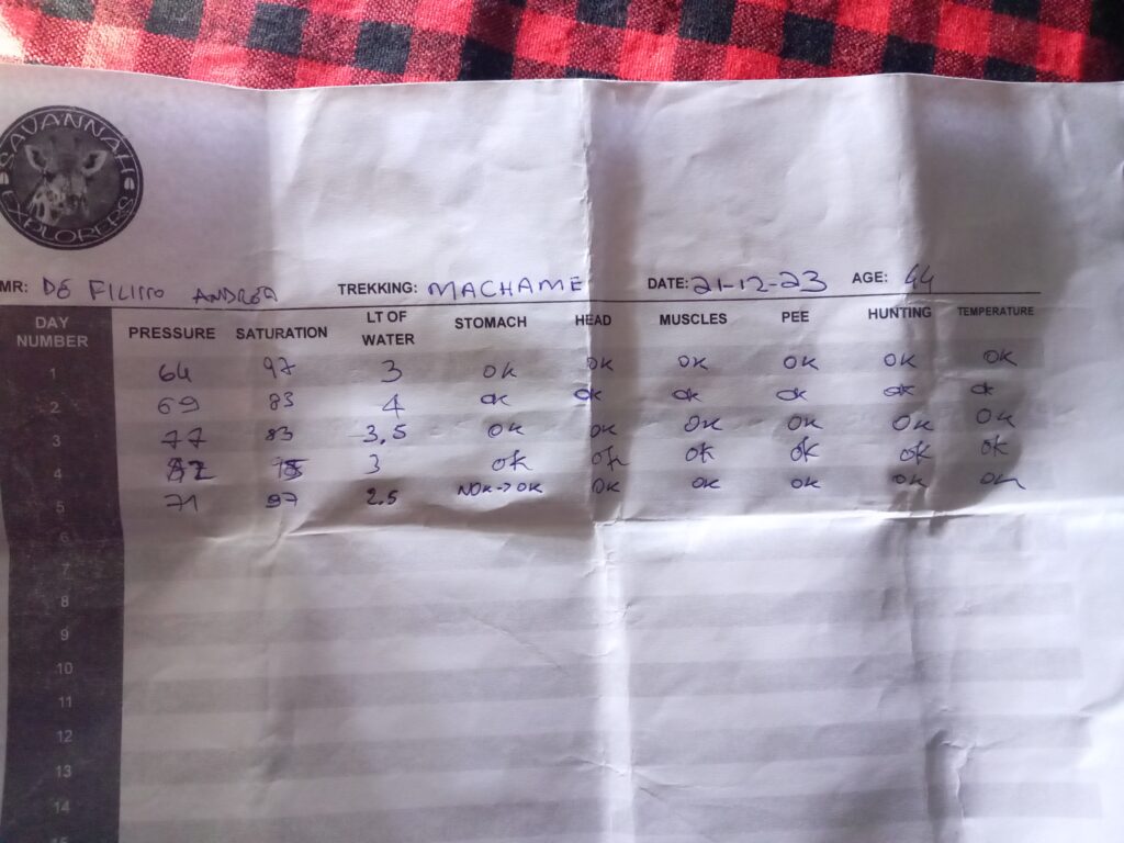
Before having lunch and then resting, we signed the register that controls who is doing the trek. It will be an exercise that will be repeated every day, when reaching the overnight camp.
During the early hours of the afternoon we remained in the tent resting and reading, waiting for the clouds to clear. I definitely recommend bringing a book or even a diary, to read or write when you are in the tent.
We then also preferred to keep the telephone connection mainly disconnected, to conserve the battery for photos and emergencies (we still had two power banks) and dedicate ourselves to appreciate the surrounding nature.
During the late afternoon it cleared up and we took the opportunity for a short walk with Jimmy and Duncan to look at the camp from a slightly higher point.
- Distance: 2 km
- Elevation gain: 70 m
- Elevation loss: 82 m
- Highest point: 3897 m
- Date: 22/12/2023
- Start time: 5:10 p.m.
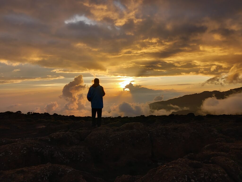
Once we returned to camp, Agnese and I stopped for a long time to see the wonder of the colors of the sunset with Mount Meru in the background making everything more magical.
Kilimanjaro trekking_Day 3: Shira Cave Camp – Baranco Camp
- Distance: 10 km
- Elevation gain: 824 m
- Elevation loss: 673 m
- Highest point: 4639 m
- Date: 23/12/2023
- Start time: 08:09 a.m.
Despite the altitude close to 4000m, the temperature in the morning was cool but not cold. Therefore, I opted to start the climb towards Lava Tower (passage above 4600 metres) still in light clothing (knee-length trousers and short-sleeved shirt). Instead, Jimmy used to leave with both long trousers and a long-sleeved shirt and even with gaiters.
I would like to say that the choice was purely subjective.
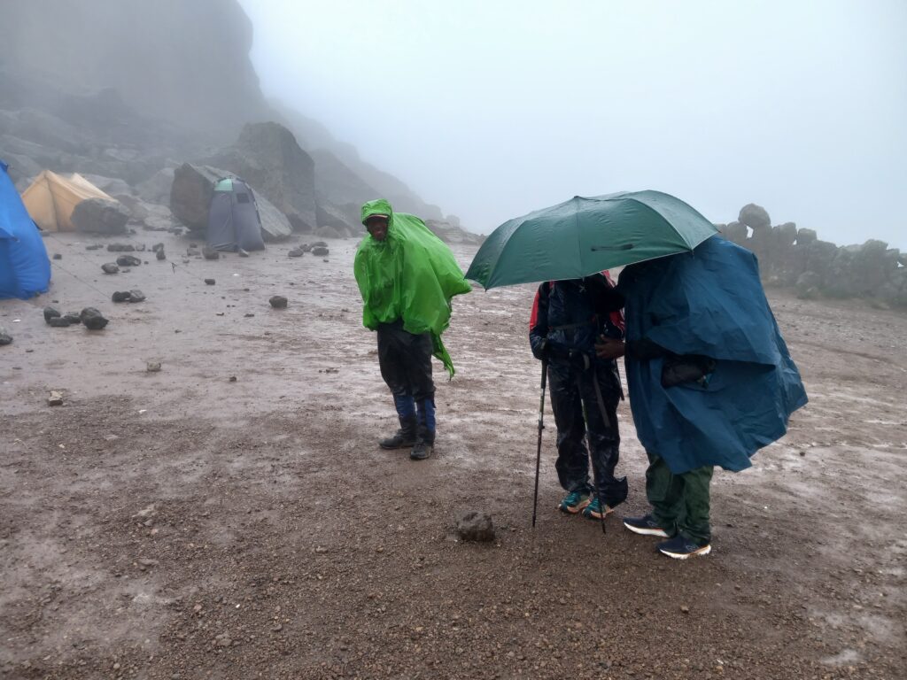
However, after about two hours we all aligned ourselves on clothing. In fact, as we went up, the weather began to change again, becoming cloudy very quickly. And invariably the rain started to keep us company again. Unlike the first two days, as we climbed, the intensity of the rain increased and at times it was even particularly freezing. When we reached Lava Tower, we were in the middle of a storm.
Managing rain, wet conditions and cold is certainly a crucial point of the entire trek. So I feel like making some further recommendations:
- Bring at least two pairs of shoes
- Bring at least two pairs of rain-jackets (ideally bring also a poncho to completely cover both you and backpack. Please: do not bring umbrella…..many local had it, but it not recommended)
- Bring at least a rain trouser cover
- Bring two or three pairs of gloves
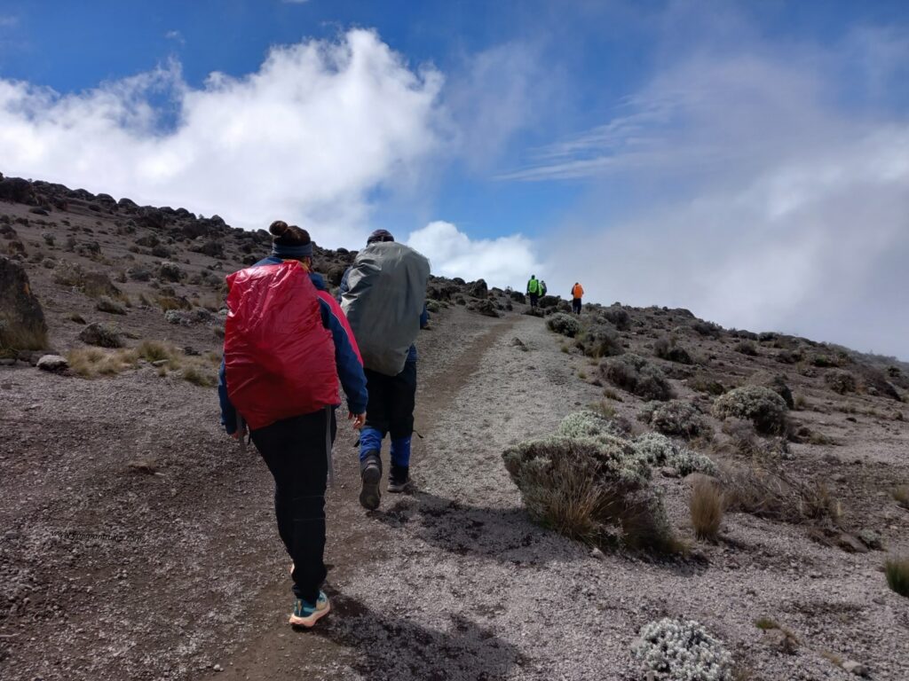
- Bring at least a cover for your backpack (from the pictures you will always see it, regardless of the rain)
- Pack spare clothing in closed plastic bags
- Pack all your money, documents and electronic devices in closed plastic bags
The descent from Lava Tower towards Baranco Camp was particularly slippery due to the amount of rain and the fact that the paths had become small streams. Plus, for the first time we had several minutes of annoying wind. Sunglasses and buff helped to protect our faces.
We finally reached Baranco Camp, certainly a little wet and cold.
Furthermore, the day had certainly left us with an important warning. While climbing towards Lava Tower we met a group of porters who were carrying the body of one of their companions back to the valley, who had died hit by a falling stone.
I know well the risks of going to the mountains and I want to report this fact to avoid underestimating the situation, even if the trekking does not involve technical difficulties.
Once in the tent and after some warming up inside the sleeping bag we then enjoyed an evening and a night with the sky completely cleared of clouds.
Kilimanjaro trekking_Day 4: Baranco Camp – Barafu Camp
- Distance: 5 km
- Elevation gain: 469 m
- Elevation loss: 405 m
- Highest point: 4226 m
- Date: 24/12/2023
- Start time: 08:04 a.m.
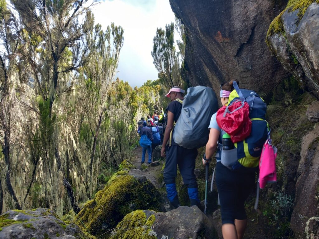
The day included the ascent of the Baranco Wall, perhaps the most technical part of the whole trek with two or three slightly exposed passages where you need to pay close attention.
Personally, I enjoyed this path a lot and took the opportunity to take several photos. The only negative (for me) was the constant instability in my intestines which forced me to take necessary breaks from time to time.
The day then proceeded to Karanga Camp with no differences from other days: clouds rising from below during the morning, brief clearings, then more clouds. And so on.
Once at Karanga Camp the guides opted for a long break for lunch. It was perhaps the only time that Agnese and I would have decided differently than the guides: we would have opted for a short break with a direct climb to Barafu Camp.
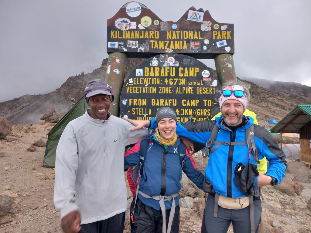
- Distance: 3.6 km
- Elevation gain: 642 m
- Elevation loss: 8 m
- Highest point: 4669 m
- Date: 24/12/2023
- Start time: 00:09 p.m.
After the break we climbed quite quickly towards Barafu Camp, trying to avoid the inevitable rain announced by loud thunder near us.
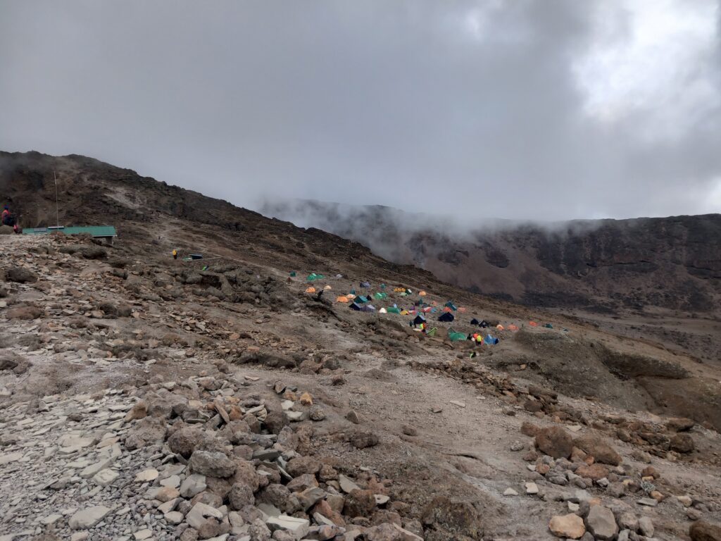
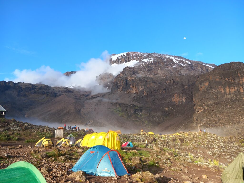
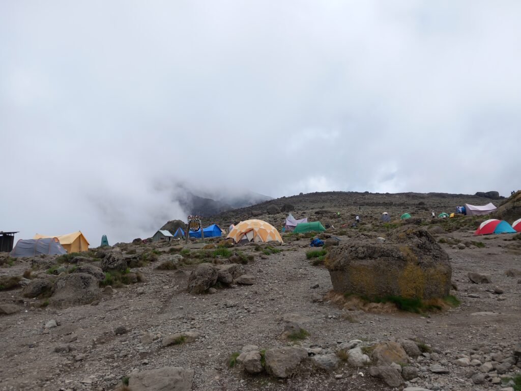
Barafu Camp is very large because it is the starting point for the final climb (last 1250 m as elevation gain) of Kibo. Here we found lots of people, preparing for the final climb in a few hours.
Kilimanjaro trekking_Day 5: Barafu Camp – Mweka Camp
- Distance: 7.6 km
- Elevation gain: 1106 m
- Elevation loss: 1069 m
- Highest point: 5748 m
- Date: 24/12/2023 (start)
- Start time: 11:47 p.m.
We rested a few hours at the Camp, as our climb was scheduled for 11.30pm.
We set off with a beautiful starry sky and when several groups were already on the ascent route. In front of us we could observe the large snake created by the headlamps turned on.
We set off at a slow (but not very slow) pace, as we passed so many people on the climb. In the last two days, both Agnese and I had not had any problems with the altitude and we felt quite prepared.
Instead, once I passed 5000m, my intestines decided to put me to the test. I started to feel the need to take frequent breaks and my pace became heavier and heavier by the minute. Despite this we continued to climb and pass other hikers (many in obvious difficulty), accompanied by encouragement and songs from the guides and some porters.
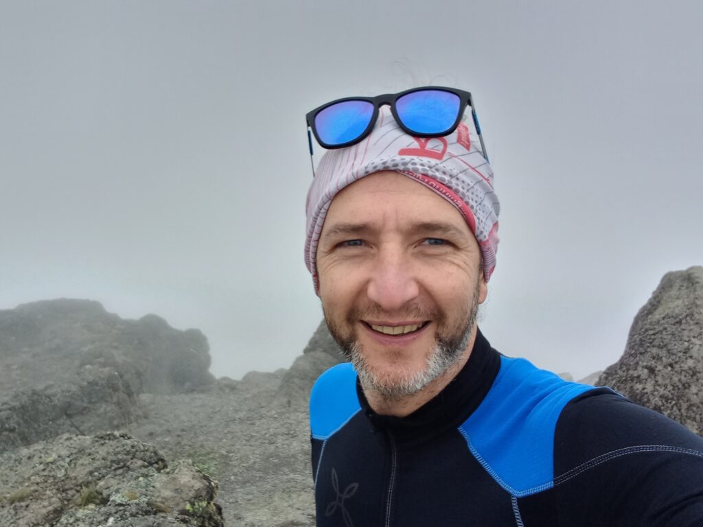
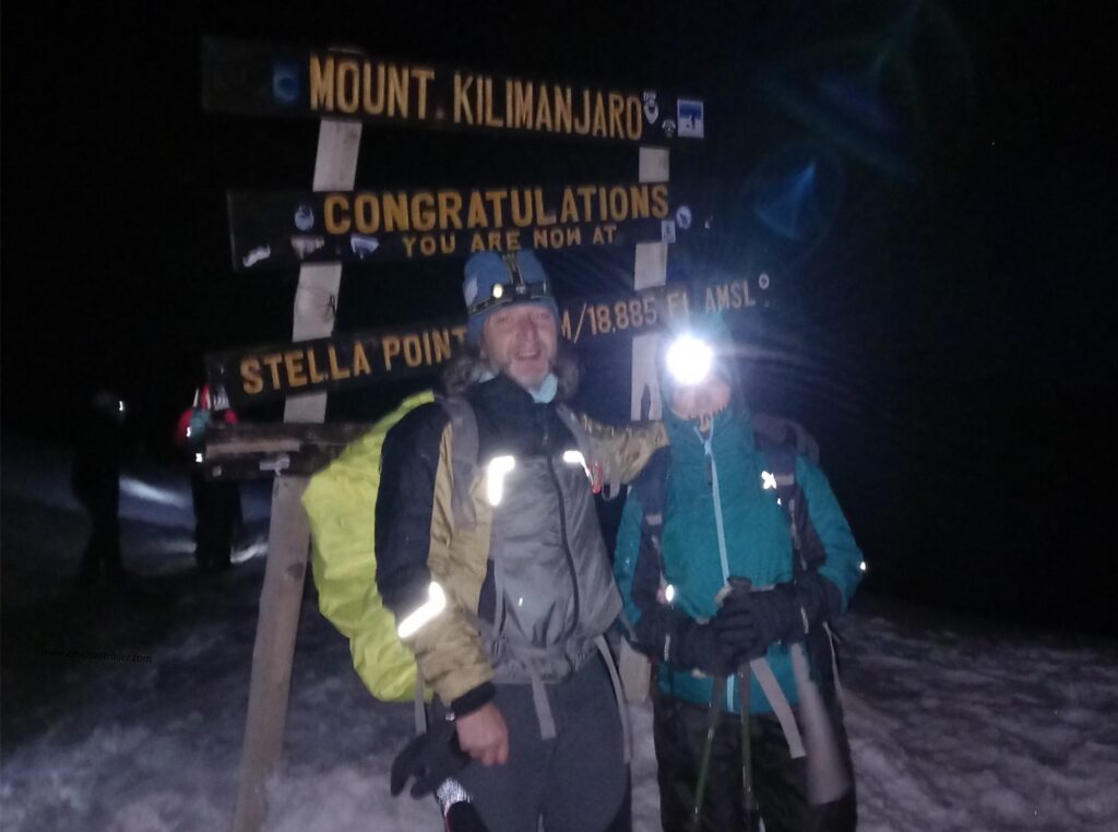
We arrived at Stella Point (5756m) at five in the morning, certainly a little later than the time expected by the guides based on our ability and condition. Indeed, still early to reach Uhuru Peak (5895m). However, my condition had definitely worsened and despite being very lucid, Agnese and I opted to return to a lower altitude, avoiding running into serious problems with at least another 3 hours (estimated time for Uhuru Peak) with little oxygen available.
As we often go to the mountains, we know our limits well and we also know when it’s time to stop. In retrospect, I can say that it was the right choice.
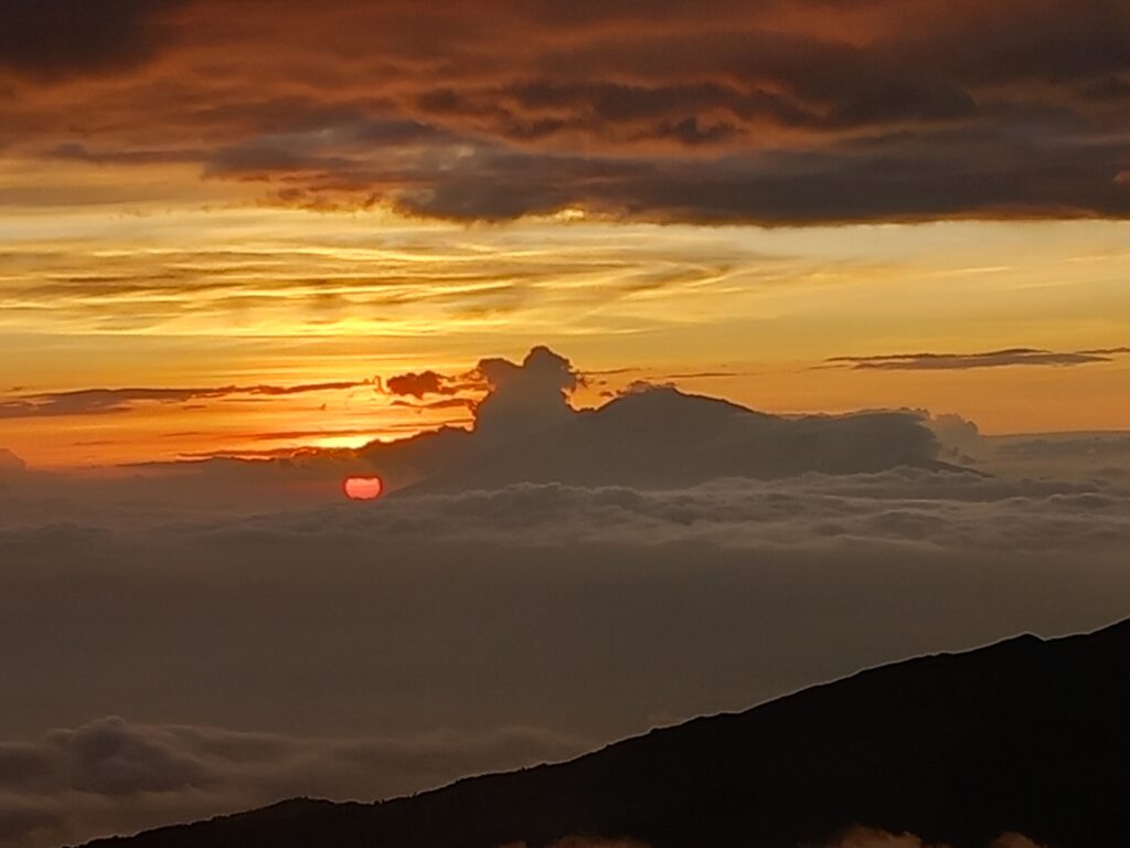
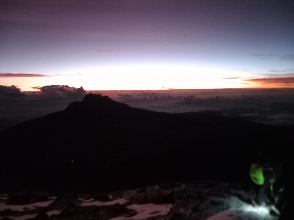
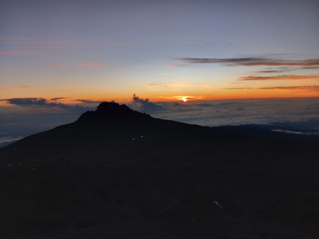
During the descent towards Barafu Camp, we were able to enjoy the sunrise behind Mawenzi. Another beautiful image imprinted in our eyes (and partially captured via cell phone).
- Distance: 7.4 km
- Elevation gain: 3 m
- Elevation loss: 1542 m
- Highest point: 4629 m
- Date: 25/12/2023
- Start time: 10:52 a.m.
Once we reached the camp, we threw ourselves into the tent to recover some energy as we would have had to leave almost immediately to go down to Mweka Camp.
The break (just under 2 hours) allowed Agnese and me to recover some energy. We then set off for the long descent towards Mweka Camp.
The first part of the descent was easy, getting us to High Camp (3950m) in just over an hour.
After a short break, we began the second part of the descent, this time on a much more technical trail.
The situation then quickly changed (and worsened) with the arrival of a violent storm that transformed the path into a small river.
We then finally arrived at Mweka Camp (3100m), when the rain was stopping. The following day we discovered that those who were descending few hours behind us had much more difficulty also due to the lightning. One unfortunately killed one of the hikers.
During the evening we spoke again with the guides and did the daily check-up, also trying to understand if my conditions had restabilized after the crisis of the night towards Stella Point.
Kilimanjaro trekking_Day 6: Mweka Camp – Mweka Gate
- Distance: 9 km
- Elevation gain: 0 m
- Elevation loss: 1351 m
- Highest point: 3061 m
- Date: 26/12/2023
- Start time: 08:08 a.m.
In the morning we woke up in good condition even if mine were not yet completely back to normal.
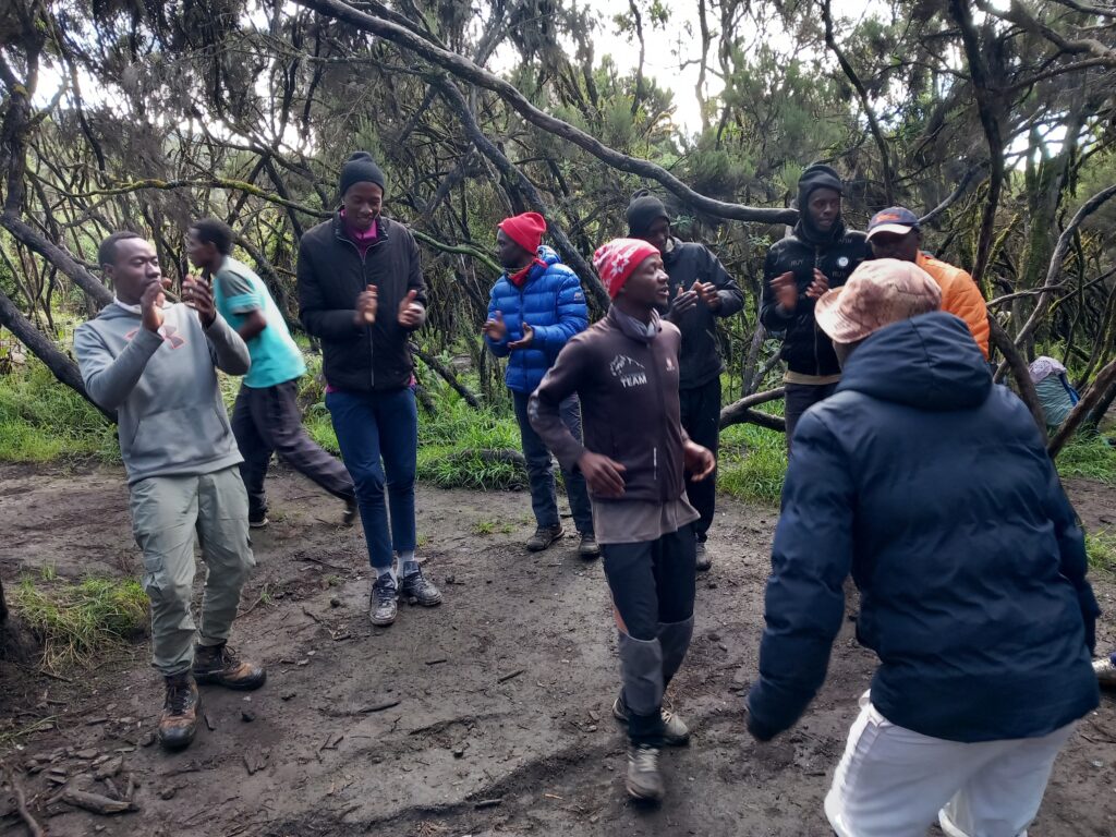
After breakfast we participated in the classic closing speech of the trek, in the celebrations and songs sung by the guides and porters and obviously we expressed our thanks for the support received.
Then we set off for the last session of kilometres, returning to the rainforest and admiring the surrounding vegetation.
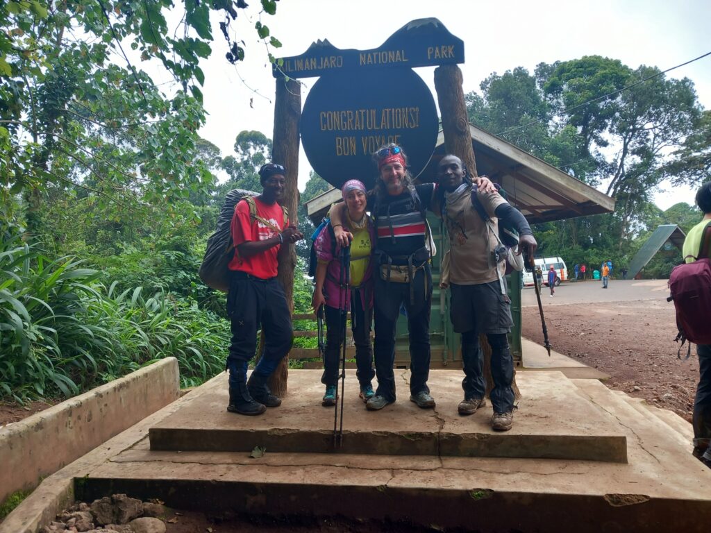
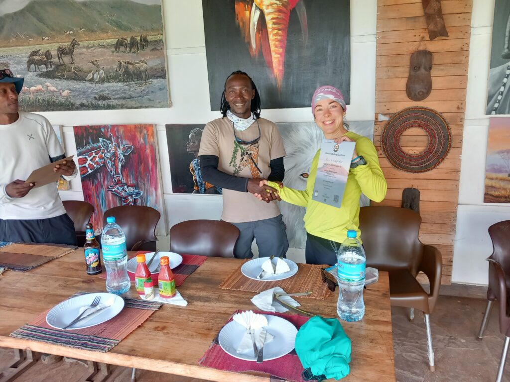
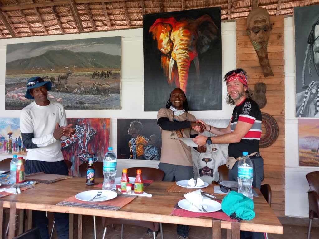
Once we reached the Mweka Gate we concluded our trek with the classic ritual photos, with lunch together with the guides and with the delivery of the certificates, reserved for those who arrive at Stella Point during the ascent of the Kibo.
It was certainly another beautiful experience, lived together by me and Agnese.
Additional information
If you want more information or technical details related to this route, please do not hesitate to contact me or comment below.
Other information about races, results and equipments at the following links: Trail & Running | EmigranTrailer.
Enjoy Hiking & Trekking!
Andrea De Filippo
Original post in english language. For other languages, please open with a web browser (i.e. Chrome) and apply the automatic translation
Related projects and articles
You might find of interest other similar articles here: Exploring Routes | EmigranTrailer


