
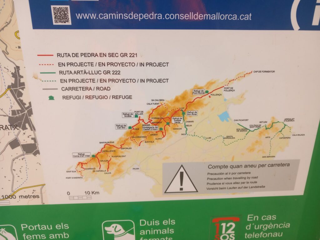
The GR221 is a hiking route that connects the southwestern part of the island of Mallorca to the northeastern part, crossing coastal and mountainous areas, and it is part of the so-called “camins de pedra” (Inici – caminsdepedra (conselldemallorca.cat)), crossing the Sierra Tramuntana through paths outlined by dry stone walls and various characteristic villages which I will tell you about later.
It is a path that can be divided into various stages based on training and the time available. For private and work reasons, our time available was three full days and therefore we made good use of our basic training to be able to complete the entire journey in good time (136.3 km with 6179 m+ and m-).
Before going into the details of the individual days, I’ll leave some general information.
The path is not well marked, except in the vicinity of some inhabited centers and in the last stage from Sóller to Pollença. Therefore, it is advisable to have the gpx track with you (we had two and, in some points, it was not even easy to follow them).
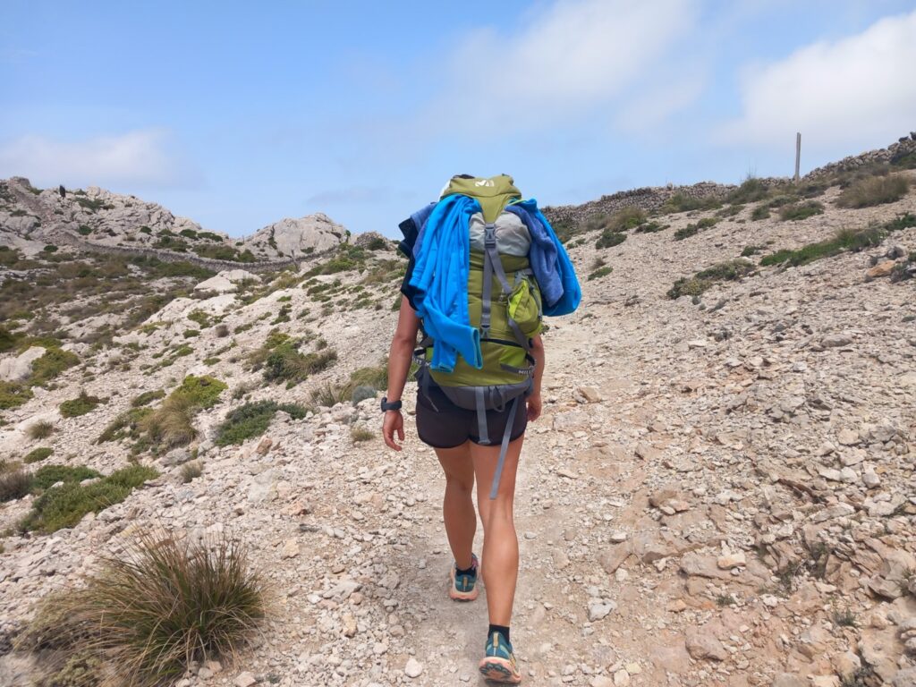
There are some particularly technical passages, especially downhill. Therefore, having to have a backpack on your shoulders, it is advisable to be adequately prepared to manage fatigue and balance.
The weather has been quite favorable for us. We caught two drops of rain in the morning of the first day and then a good thunderstorm when we were only 15km from Pollença on the last day. However, the rain can be particularly insidious on some parts of the route which I will detail later. Therefore, it is necessary to carefully study the speed at which one intends to carry out the single stage and the related weather conditions.
The temperature was ideal for spending many hours on the trails. We never really suffered from the heat, except for a couple of hours in the early afternoon of the second and third day, and even on the highest altitudes between 900 and 1200m we did not suffer from the cold.
There are several villages along the way, but in some cases they are quite far apart, so it is advisable to have a good supply of food and water with you. We traveled on average with 4.5 liters of water and mineral salts, plus a lot of things to eat.
Let’s go into the details of the individual stages.
GR221_Day 1: Port d’Antratx – Banyalbufar
- Distance: 41 km
- Elevation gain: 1854 m
- Elevation loss: 1745 m
- Date: 23/05/2023
- Start time: 07:29 a.m.
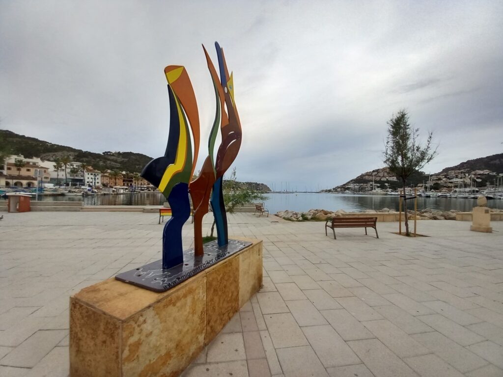
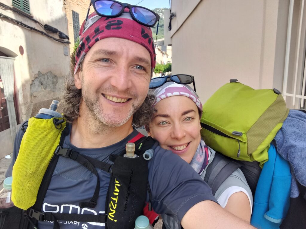
On Monday night we landed in Palma de Mallorca and immediately took a taxi (about €70) to take us to Port d’Antratx, from where we had decided to leave the following morning. After sleeping at the Hotel Brismar and a hearty breakfast in the early morning, we set off from the small port of this very pretty town and started our GR221.
In the first kilometres, the route was neither indicated nor officially traced. Therefore, we relied on the tracks we had downloaded and followed our gps.
The first 5 km were all uphill, very steep at first and then becoming gentler, but giving us a nice view of the west coast and the Sa Mola peninsula behind us.
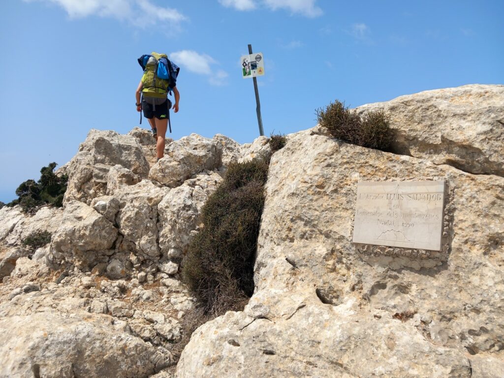
At the top of the hill we had our first encounter with wild goats, which will prove to be a constant presence throughout the journey.

In the following hundreds of meters we reached Pas Vermell and from here we passed onto a greener and more luxuriant side of this first mountain.
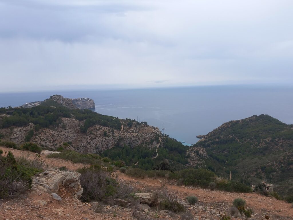
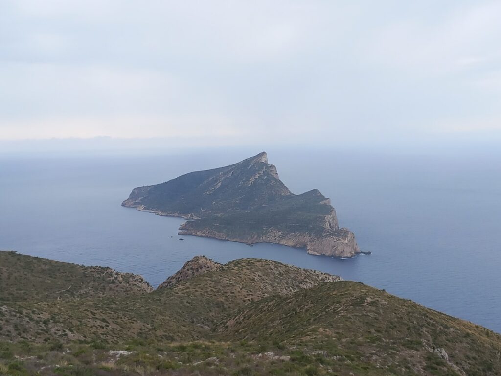
Along the subsequent descent we began to see the first houses of the village of Sant Elm and above all the particular shape of the island of Sa Dragonera (Dragonera – Wikipedia).
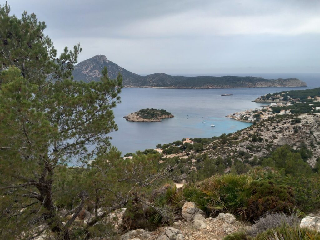
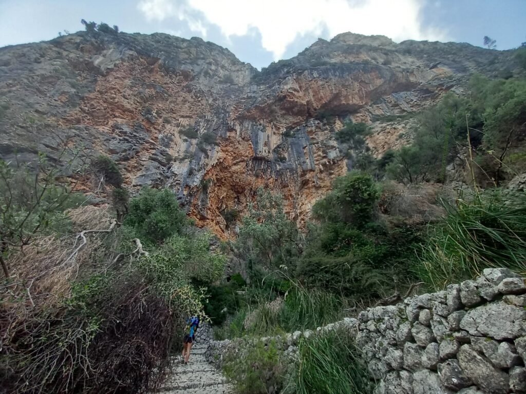
At Sant Elm (km 9) we made a small passage on the beach and then we continued through the main road of the village, then returning to enter the nature of the Trapa park from which we have a constant and wonderful view of the island of Sa Dragonera.
Along this route, a light rain made some rocks on which the trail climbs particularly slippery, so we had to pay particular attention.
After about 12.5 km from the start we found the first indications of the GR221. As can be seen from the table, only some portions of the route are complete (whole red line); the others are in the planning stage (dashed red line).
Once around the Puig de ses Basses (492 m) we began to see the jagged coast facing north (km 15).
For the following 6 km we first traveled along an easy mule track and then the M-10 regional road, up to a curve on the right of which we found indications inviting us to follow the path on the right in Es Ses Fontanelles.
Here we crossed a private house (which only asks you to respect the place and keep quiet) where the owners had left bottles of water unattended on the windowsill, which we could eventually take with an offer of one euro.
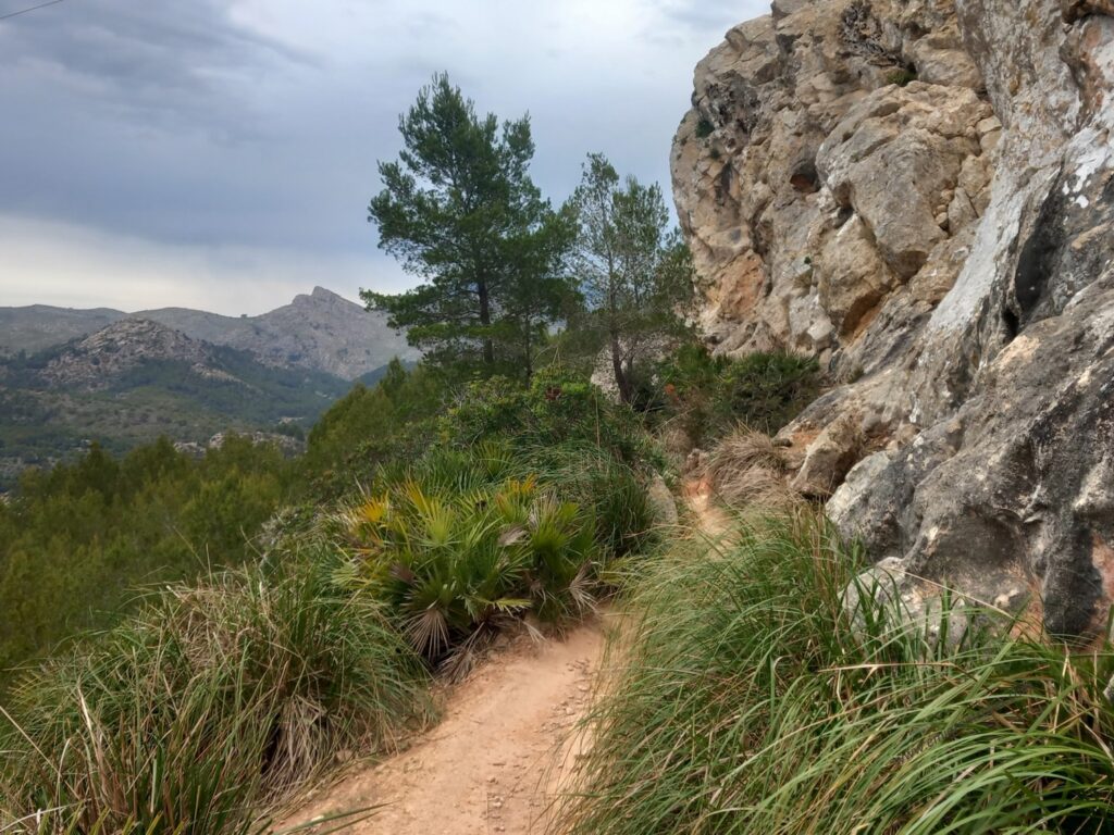
After the house we started the first long climb of the day. It was a short climb in terms of distance (about 4 km), but demanding due to the difference in height (about 550 m) on rocky terrain, but above all without any clearly visible trace other than sporadic cairns of stone scattered on the various ramps. This is certainly one of the points where it was essential to have both GPS tracks with us.
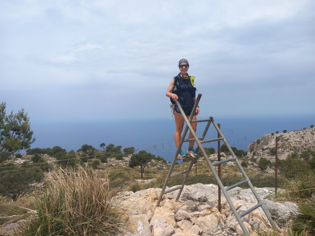
We descended just below the Mola de s’Esclop (928 m), passing one of the many artificial ladders that allow you to cross the fenced areas along the GR221. Obviously in most cases we found simple gates.
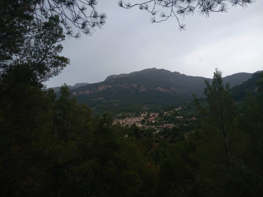
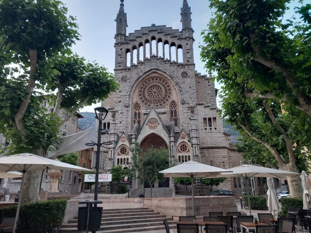
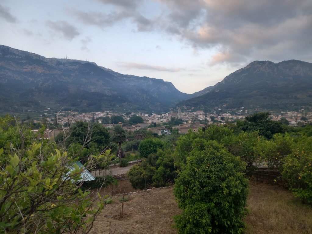
From here we walked a long descent between paths and mule tracks until we reached the village of Estellencs, completely immersed in the green Majorcan mountains (Estellencs – Wikipedia).
After a short break and water refreshment we set off again to complete the last 7 km and the first stage of the day with the aim of reaching Banyalbufar as soon as possible so that we could then enjoy the evening at sunset over the sea (Banyalbufar – Wikipedia).
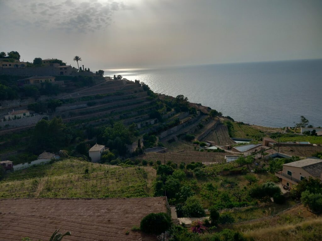
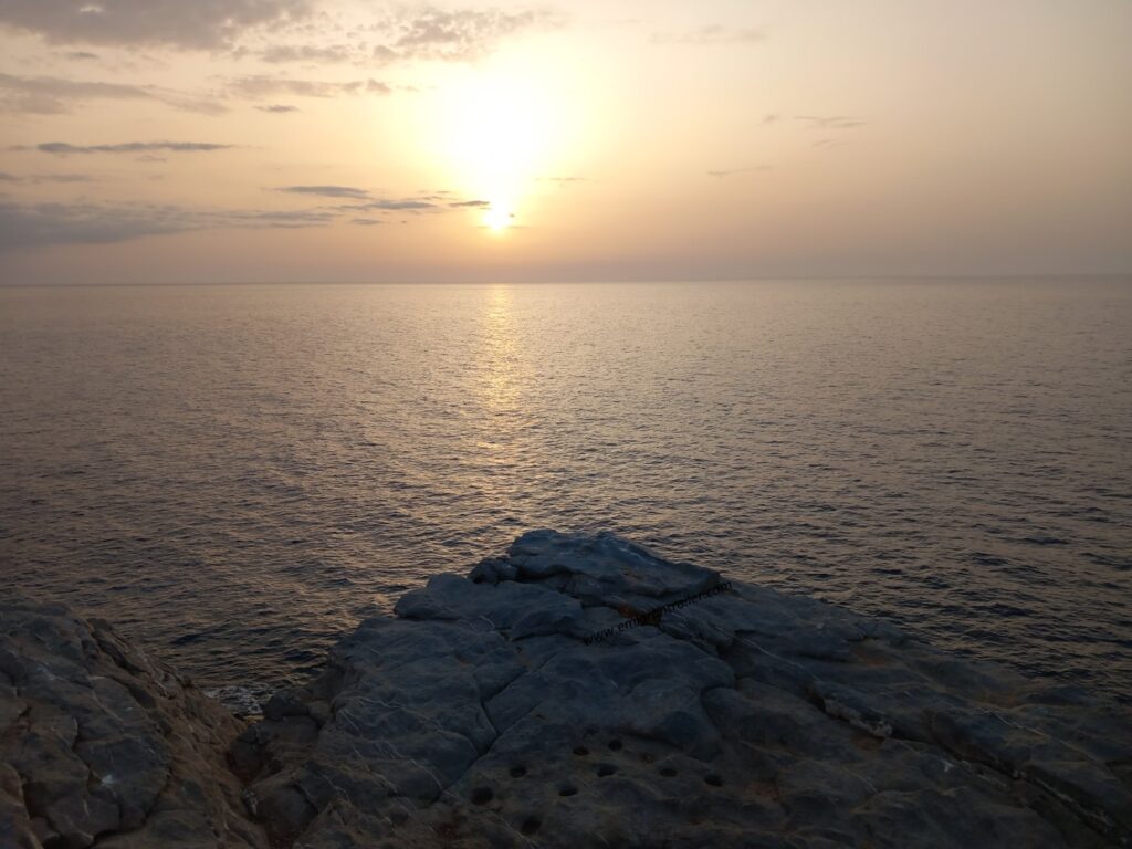
We arrived in Banyalbufar by 6 pm with plenty of time to do a little shopping for the following day, organize the material, have a pleasant dinner from the terrace of our hotel/restaurant (Hostal Sa Baronia) and above all, go for a walk after dinner towards the Port de Banyalbufar at sunset (note: distance and altitude not recorded, but it was not flat! 😊).
GR221_Day 2: Banyalbufar – Sóller
- Distance: 42 km
- Elevation gain: 1968 m
- Elevation loss: 2066 m
- Date: 24/05/2023
- Start time: 07:44 a.m.
Having designed the second day with similar distance and elevation gain to the first, we set off on Wednesday morning more or less at the same time and covered the first 8km of the day at a good pace until we reached Esporles (Esporles – Wikipedia).
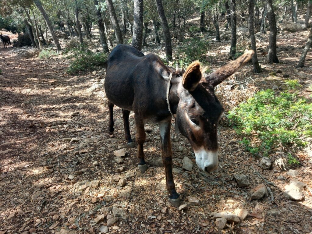
Once we left the narrow streets of the town we entered a wooded area, accompanied by the inevitable presence of wild goats but also by a few donkeys.
Unlike the previous day, the stage didn’t offer great panoramas in the early hours, until we came out of the woods around km 14 and were able to see the sea again for a moment.
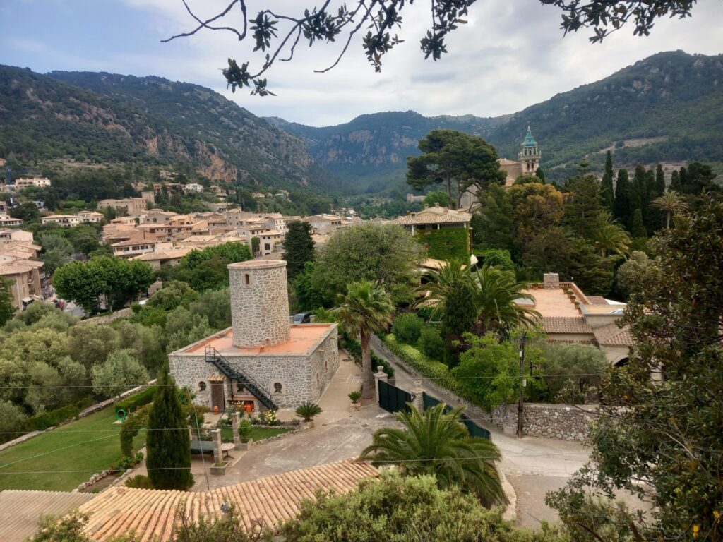
Then we returned to the woods and continued first along a short but steep descent and then the subsequent climb to go downhill to Mola de Sa Comuna (714m). From here, a short descent leads to the town of Valldemossa (Valldemossa – Wikipedia).
It is a very pretty town, very clean, but above all very touristy. In fact, we were surprised by how many people there were and it was a stark contrast to the solitude and silence we had enjoyed on the first 60km of the GR221.
Between one route and another we also struggled to find the right path. In fact, for those wishing to follow my gpx track, you can easily cut a good chunk of it inside the city. Furthermore, leaving the city we found ourselves having to decide which of the two tracks available to us to follow. In fact, one pointed towards the ascent of Muntanya del Voltor and the other towards a wider loop in the direction of Puig Gros (938 m).
We followed the second road and then we reached the highest point of the day (Es Caragolì, 944 m) around 26 km of the day.
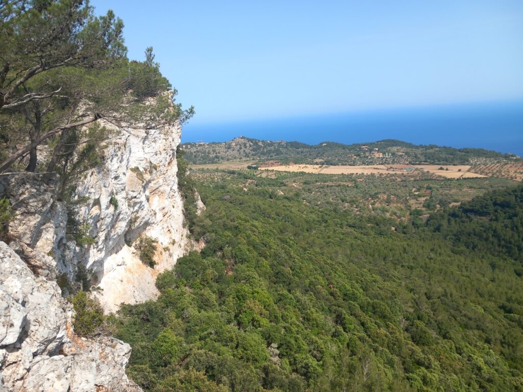
A few hundred meters later our two tracks realigned, then starting a long and technical descent, with finally a new beautiful panoramic view of the coast.
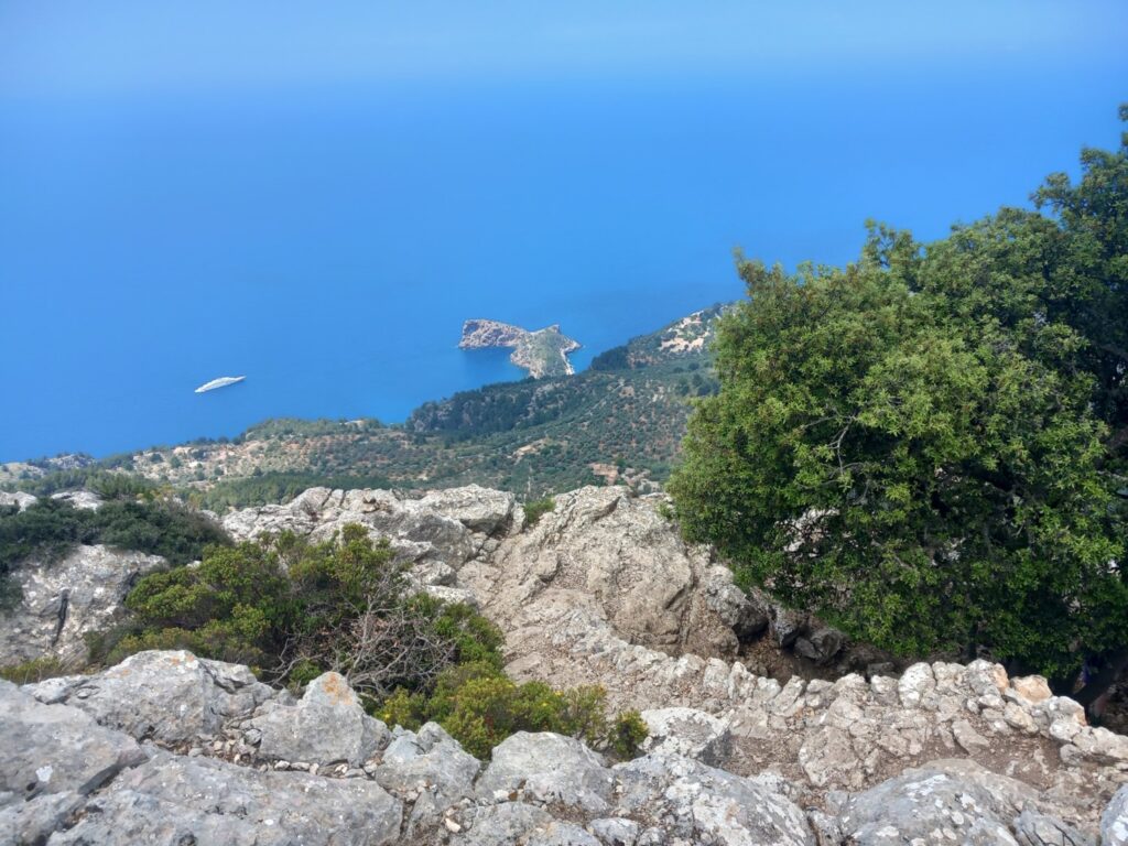
In one of the various bends, it was also possible to see the small peninsula of Sa Foradada.
We then continued the descent (sometimes in jungle mode in the final part) and then we reached Dejà, which although it looked nice, we decided not to visit, as it was once again full of people and cars.
After Dejà the GR221 offers several variants to reach the town of Sóller. The classic variant would include a slightly wider hike towards the coast and the Port of Sóller. At km 38 at one of these crossroads, we decided to continue directly to Sóller, arriving in the city center after about 42 km (Sóller – Wikipedia).
We then spent the night at Hostal Nadal a few hundred meters from the centre.
GR221_Day 3: Sóller – Pollença
- Distance: 53 km
- Elevation gain: 2357 m
- Elevation loss: 2368 m
- Date: 25/05/2023
- Start time: 06:44 a.m.
Knowing that the third and final stage would be the longest and most demanding, we decided to leave at least an hour earlier than the first two days.
The first kilometers were a slight departure from Sóller passing by the houses of Binibassì and Biniaraix, through lemon trees and the ever-present bougainvillea, and allowed us to look at Sóller from the opposite side of the second day’s finish.
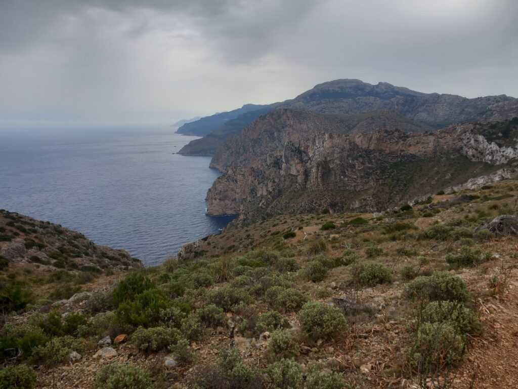
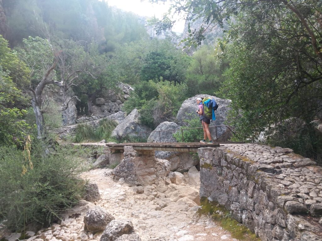
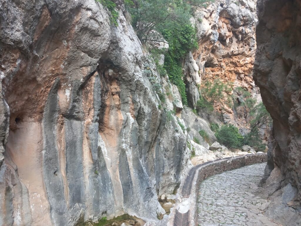
Once we left the paved road (about 4 km) we entered the Barranc de Biniaraix, certainly one of the most evocative places on the GR221 with the stones of the canyon smoothed by the wind and water and with a continuous contrast of colors between the green of the plants, the red of the vertical walls and the gray of the paved path that climbs for almost 800 meters in altitude.
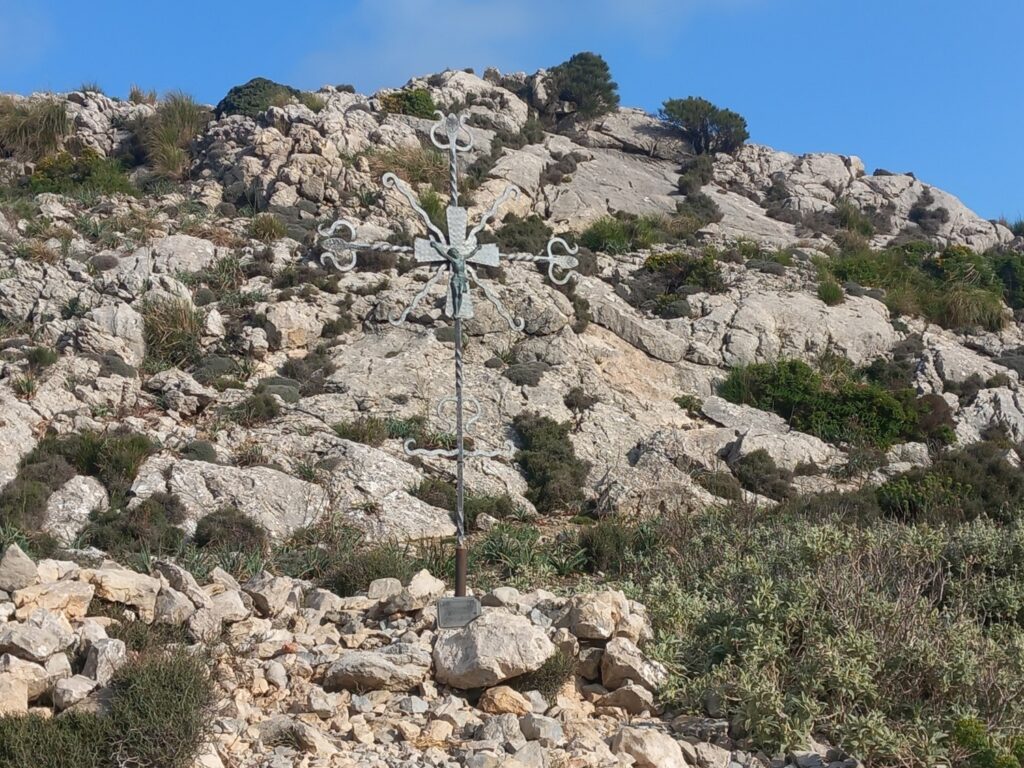
The climb ended at the top of the Coll de l’Ofre (865 m), identifiable by a small iron cross.
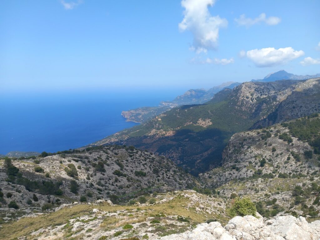
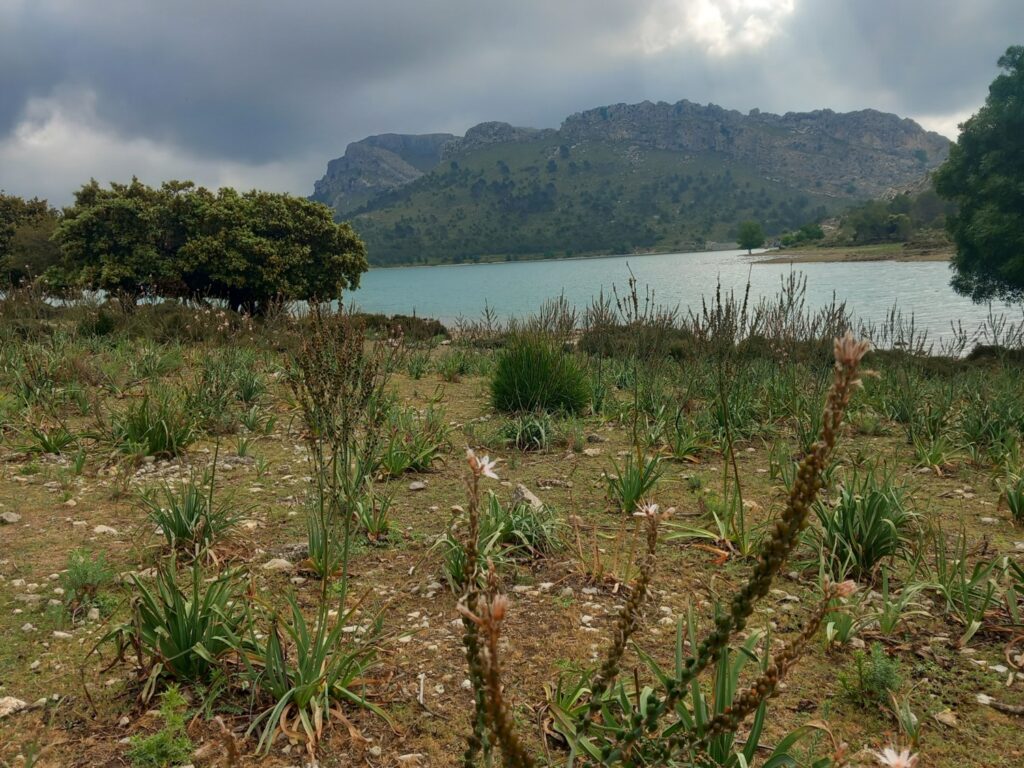
We then walked a few meters along the path and stopped to enjoy one of the most striking views of the GR221 with the Embassament de Cüber basin in the background, surrounded on the left by Puig Major (1436 m) and on the right by Puig de Sa Font (1028 m), both sometimes surrounded by clouds.
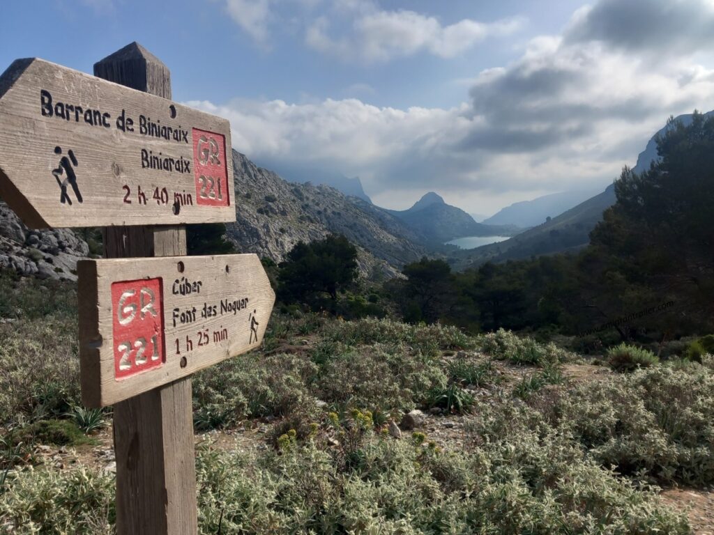
The next 3 km took us from the col to the lake along an easy path which then led us to continue around the lake in a clockwise direction, for another good kilometre.
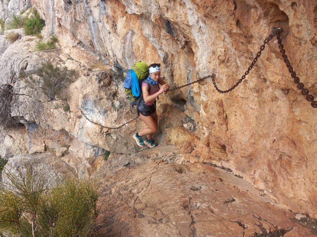
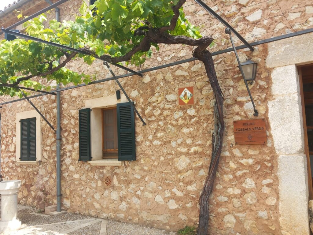
We then went up the col on the right of the lake for about 150 m and from there we began the descent towards the Refuge dels Tossals Verds. The descent was not a real descent as it was interspersed with various ups and downs, some of which were quite technical, equipped with chains.
We arrived at the refuge (km 19) about 5 hours after departure and we took the opportunity to fill our water bottles and to wet our heads, since the heat was starting to increase.
We set off again at a regular pace, aware that the long climb to the Coll des Prat (1206m) would be the last major climb of the tour, but certainly not the last effort of the day. In fact, the long descents were far more tiring than the climbs!
At the Coll des Prat we were able to admire the Puig de Massanella (1365 m), the second highest peak on the Majorcan Island.
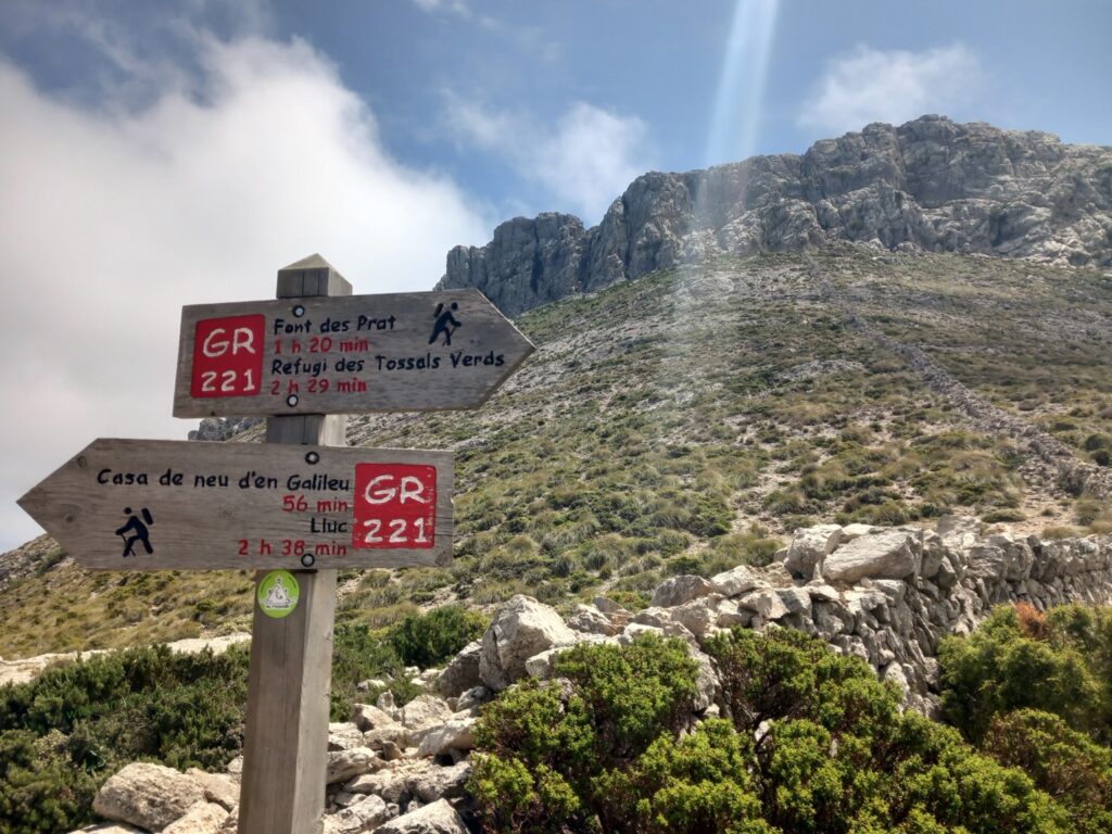
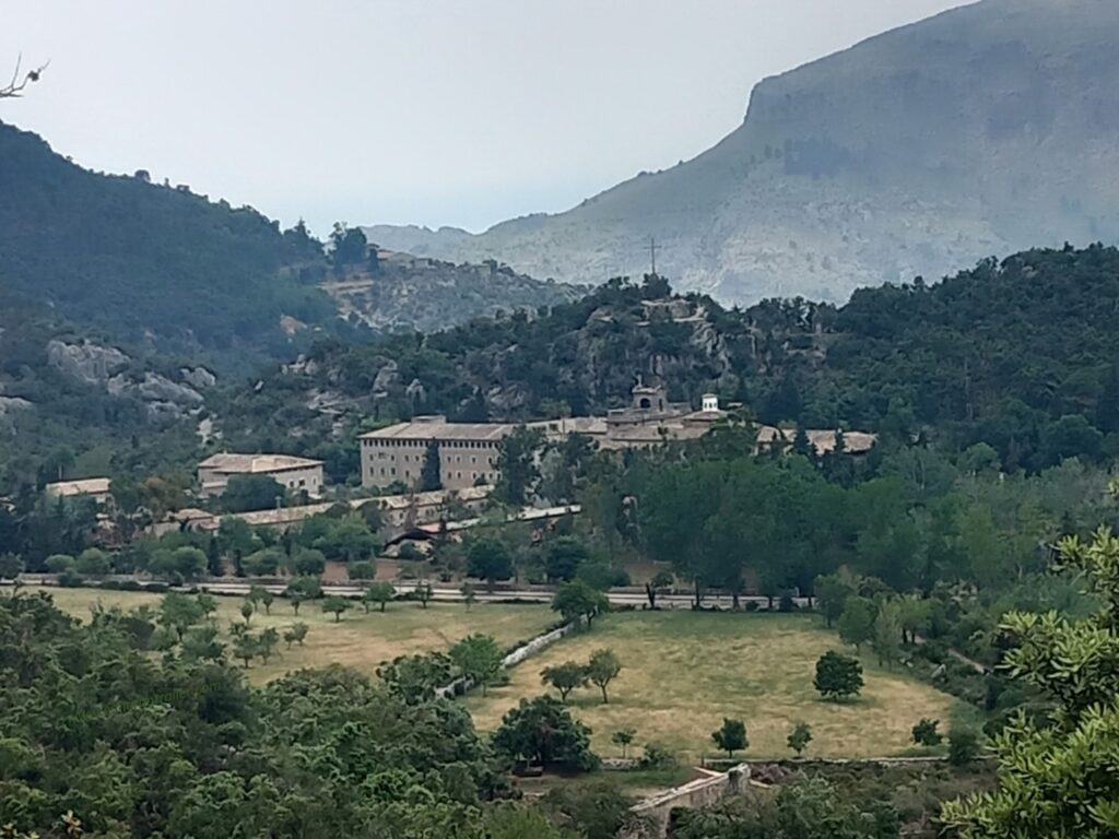
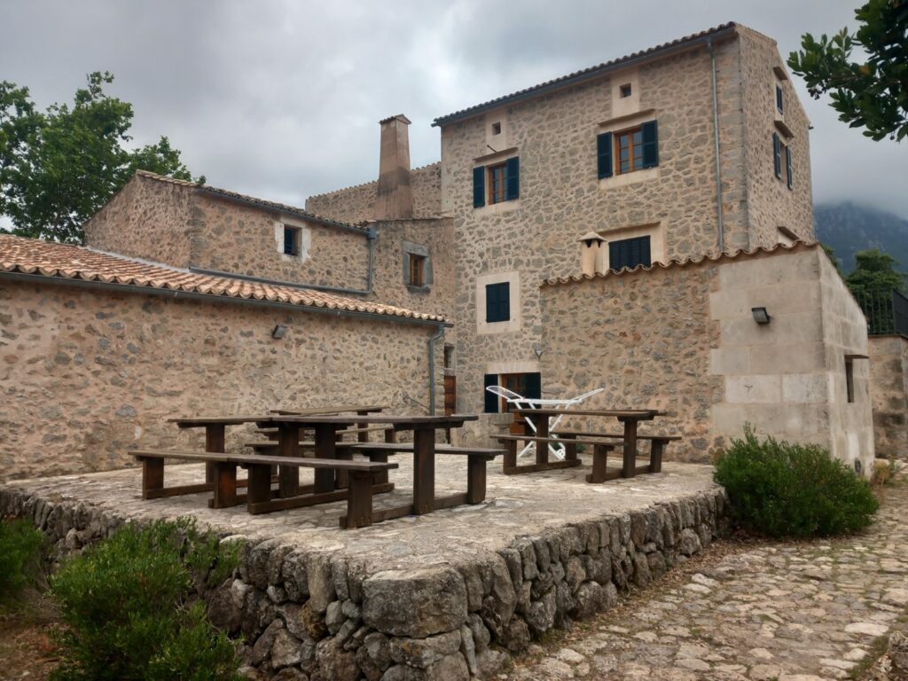
From here we made a short but technical descent to then go back up a few tens of meters up to the Coll de ses Cases de Neu (1142m). Then began the long descent towards the Santuari de Lluc, the most famous and largest sanctuary in Mallorca (Santuari de Lluc – Wikipedia).
Here we took another break but above all we had a conversation for several minutes with two nice Majorcan old ladies visiting the Sanctuary. The most interesting thing is that in three days we had seen more Majorcan places than they had seen in a lifetime, with the fundamental difference, however, that we hadn’t tried the famous Villardemossa potato coca, as one of the two nice interlocutors told us (Coca de patata de Valldemossa | Recetas Mallorquinas).
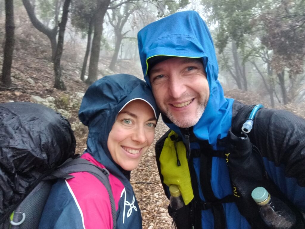
From the sanctuary we then moved in the direction of the Son Amer Refuge (km 34), behind which we began to see a conspicuous number of menacing clouds gradually and rapidly approaching.
Within half an hour we found ourselves in the middle of a heavy downpour that didn’t abandon us for the next 4-5 km.
Once out of the woods we first continued on country roads and then at km 47 again on a path, almost parallel to the Ma-10 regional road.
Once we entered Pollença we headed towards the bus station, where we finished our third stage and our journey along the GR221 route.
Additional information
If you want more information or technical details related to this route, please do not hesitate to contact me or comment below.
Other information about ideas for explorations here: Exploring Routes | EmigranTrailer.
Other information about races, results and equipments here: Trail & Running | EmigranTrailer.
Enjoy Hiking & Trail Running!
Andrea De Filippo
Original post in english language. For other languages, please open with a web browser (i.e. Chrome) and apply the automatic translation
Related projects and articles
You might find of interest other similar articles here: Exploring Routes | EmigranTrailer


Hi! Thank you for your description.
We are rally slower than you and we are planning to walk around 60 km. Which section do you suggest?
Thanks!
Hello Paolo, sorry for my late answer.
I am not sure if you have already hiked there. In any case, I would have recommended either the full section we did on the first day or the section between Valldemossa and Santuari de Lluc (a mix of our second and third day).
Andrea
Great descriptions of the GR221. I was only planning to do parts of it and your information was extremely helpful to enable me to know which parts to pick!
Thank you! I am happy that the description helped your choice at GR221! 🙂