
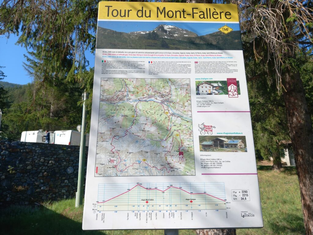
The Tour du Mont Fallère, simply indicated as TMF, is a hiking route that surrounds the Mont Fallère in the center of Aosta Valley in Italy.
It is not a long path (approx. 35 km) and can be covered in one single day or in more days depending on personal training and available time. I usually do it in a single day in trail-running version.
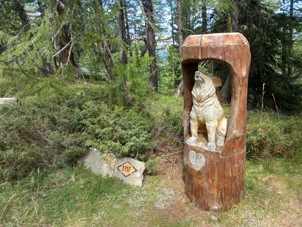
The path is very well marked (a yellow diamond with black TMF in the middle) and it is usually viable/feasible between end of June and end of September.
There are no particularly difficult and/or technical points along the route, however for most of the time it is between 2000m and 2800m of altitude, so you have to be ready for changes in the weather in the high mountains.
There are no villages along the way but only two mountain huts:
- Rifugio Chaligne: Rifugio Chaligne Valle d’Aosta – Rifugio della Valle d’Aosta
- Rifugio Mont Fallère: Rifugio Mont Fallère | Rifugio in Valle d’Aosta – Museo a cielo aperto – Siro Vierin – Rifugio Mont Fallère | Rifugio in Valle d’Aosta – Museo a cielo aperto – Siro Vierin (rifugiomontfallere.it)
If you want to hike it in more days, I would recommend you to have a look to the official website for information on the accommodations along the route: Tour du Mont Fallère – Tour du Mont Fallère (tourdumontfallere.it).
Let’s go into the details of the complete path, collected during one of my recent training along it:
- Distance: approx. 35 km
- Elevation gain: approx. 2200 m
- Elevation loss: approx. 2200 m
- Date: 19/08/2023
- Start time: 09:45 a.m.
TMF_Part 1: Etroubles – Rifugio Chaligne
The recommended starting point (and arrival) is certainly the large Vourpellières parking lot, in the municipality of Etroubles, a few tens of meters from the Hôtel Beau Sejour.
Here, next to a small supermarket, you can find the route table.
The first km is uphill on a paved road passing the camping area.
Then leave the paved road and to the right of an abandoned building take the mule track that leads into the woods. After approx. 1.5 km from the start, turn left and continue for about 800 meters along the mule track.
Here, on the right, a path begins which climbs steeply for about 300 meters in altitude.
At the end of the path, take a slightly downhill mule track for about one kilometre.
Tight turn to the right and the road climbs again for another 300 meters in altitude.
Here the forest becomes less sparse and opposite you begin to see Mont Fallère.
Then begins a new mule track, this time flat or slightly downhill, remaining all the time around 1900m above sea level.
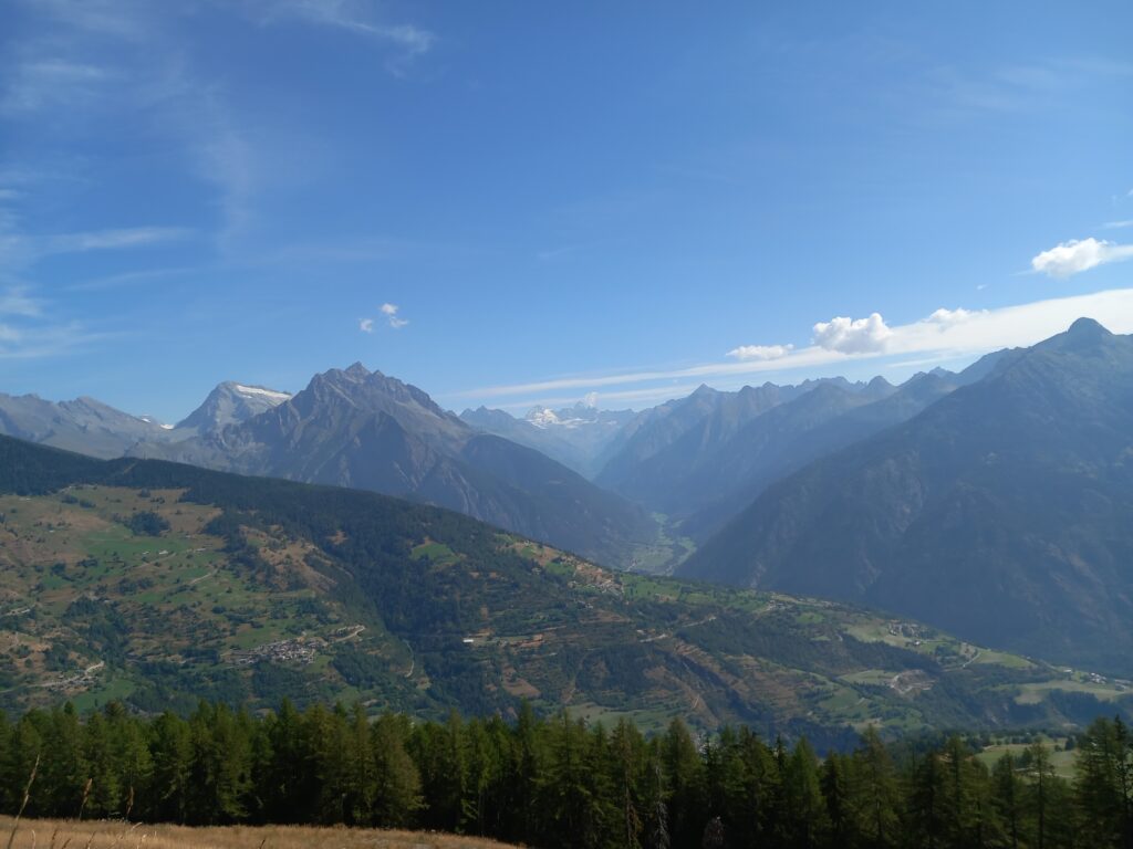
On beautiful sunny days, along this stretch, you can appreciate both the Valpelline and the Matterhorn in the background.
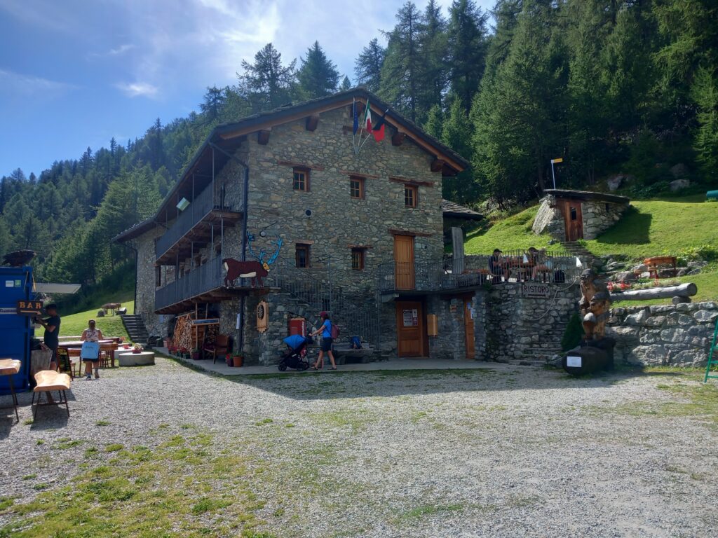
This mule track ends after approx. 4 km at the Rifugio Chaligne where you can find a water fountain for refreshment or where you can also decide to stop for a long break or for the evening.
In total, this first part is approx. 10 km with approx. 750 meters of elevation gain.
TMF_Part 2: Rifugio Chaligne – Rifugio Mont Fallère
This is probably my favorite part of the whole tour.
You immediately begin to climb from the Rifugio Chaligne along a path that becomes steeper and steeper meter by meter.
Along this stretch there are also a couple of benches and some wooden structures.
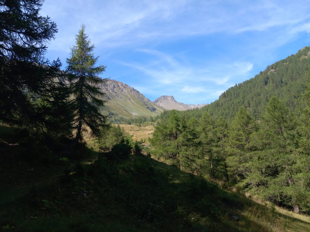
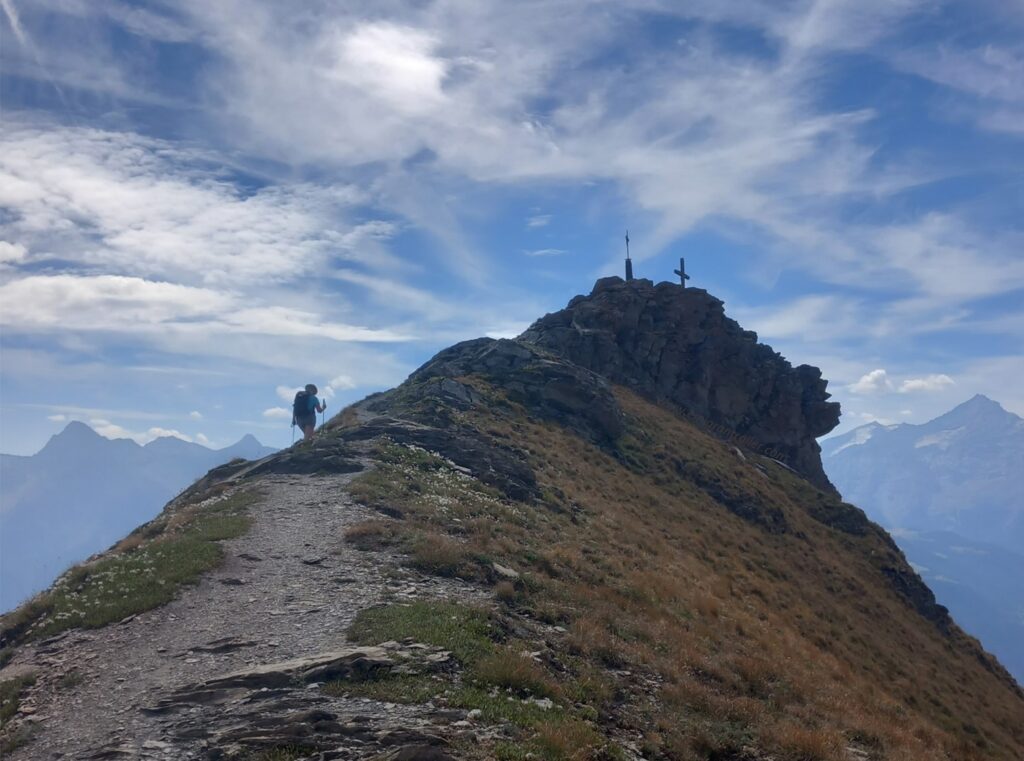
At about 2300 m above sea level you leave the wood and walk along the most beautiful and panoramic part of the tour. It is a high-altitude path that allows you to see all the highest peaks of the Aosta Valley.
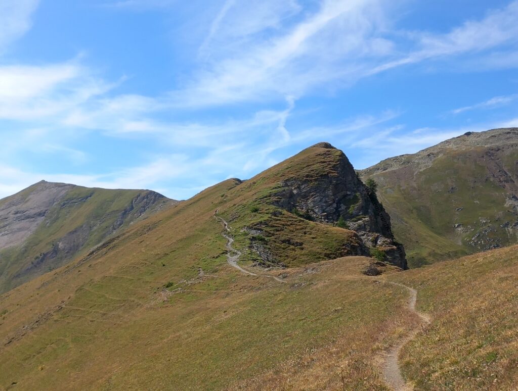
This stretch ends on top of Punta Chaligne (2611m a.s.l.), one of my favorite mountains.
From the top you descend about a hundred meters until you reach the Col de Metz (2492m).
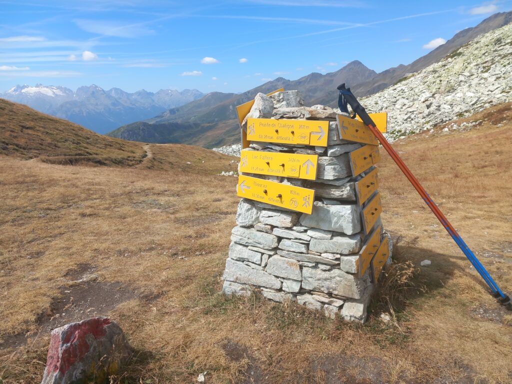
Here (approx. 15 km from the start) you turn west and begin a section of 3.5 km, first downhill and then uphill, until reaching the Lake Fallère.
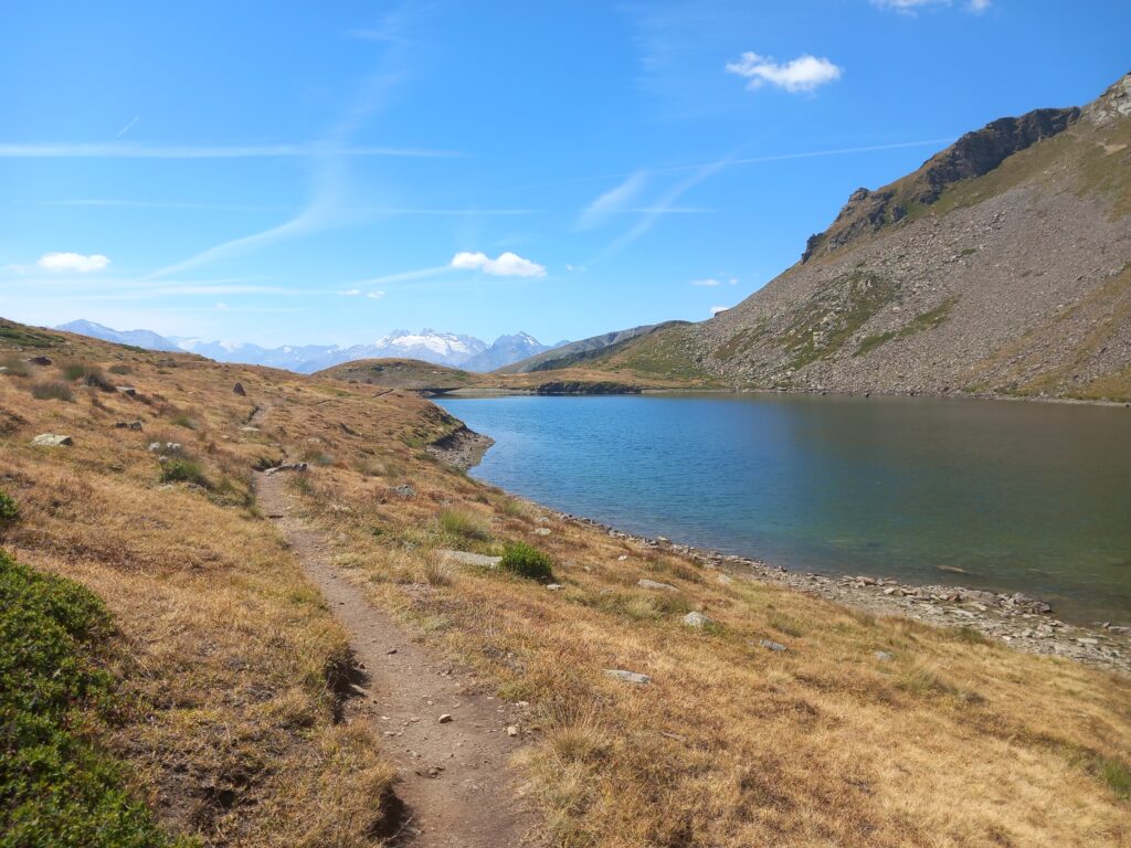
After skirting the lake you come to a small crossroads: on the right you go up towards the top of Mont Fallère (3061 m a.s.l.); on the left you continue along the route of the Tour du Mont Fallere.
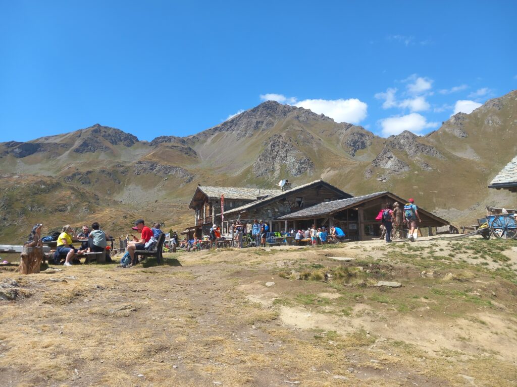
With a short drop in altitude you then arrive at the plateau in the center of which the Rifugio Mont Fallère is clearly visible.
At this mountain hut you can find a water fountain for refreshment and you can also plan a long stop for the day or the night. Note that on summer weekends it is always full of hikers and/or mountain-bikers.
In total, this second part is approx. 11 km with approx. 1000 meters of elevation gain.
TMF_Part 3: Rifugio Mont Fallère – Etroubles
When you arrive and when you leave the hut, you cannot fail to admire the beautiful wooden structures of Siro Viérin, owner of the Rifugio Mont Fallère as well as a excellent wood artist: Museo a cielo aperto – Rifugio Mont Fallère | Rifugio in Valle d’Aosta – Museo a cielo aperto – Siro Vierin (rifugiomontfallere.it)
Once you leave the hut there are a few hundred flat meters in the Les Crottes basin and then the final climb of the entire tour begins.
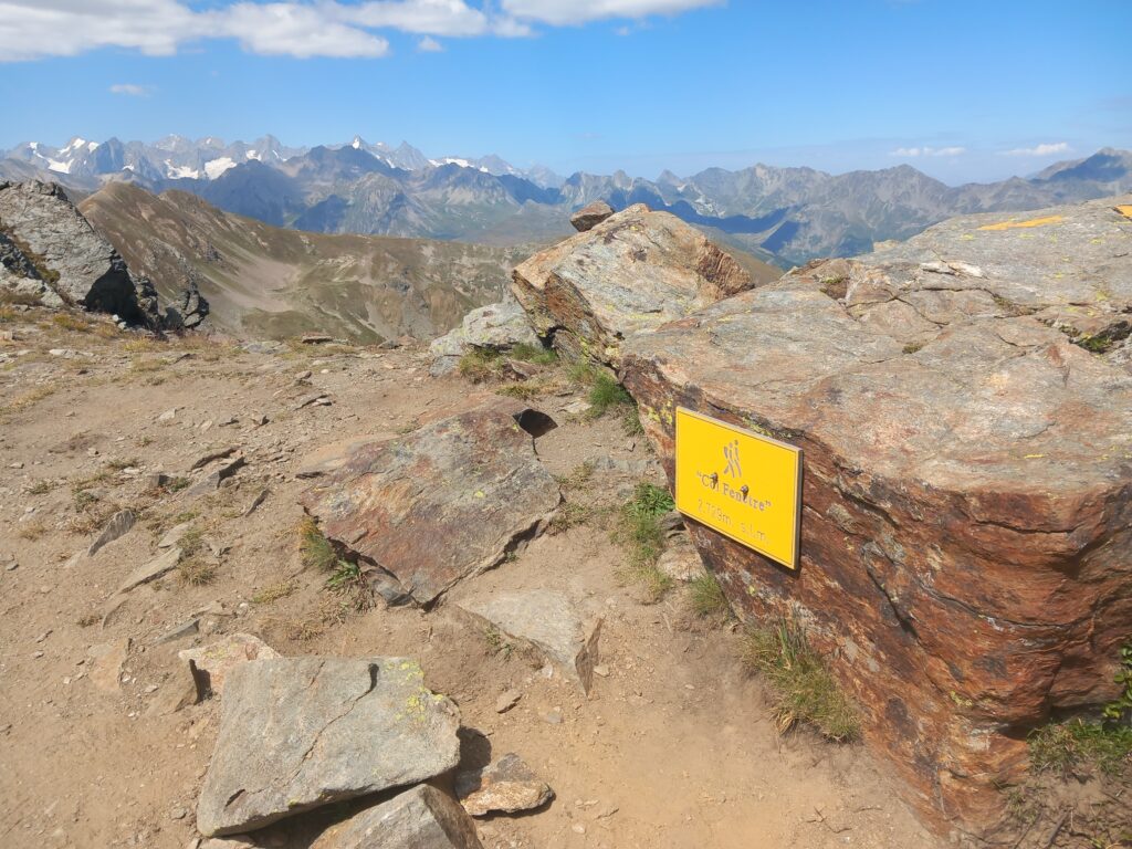
After about 1.5 km you reach a crossroads. On the right starts the climb towards the Morto lake. The TMF route instead continues on the left and climbs up to Col Fenêtre at an altitude of 2729 m a.s.l.
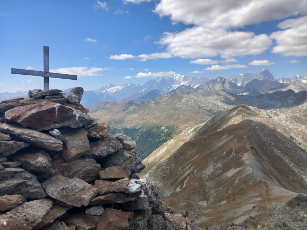
After the pass, a further short climb leads to the base of Monte di Vertosan (2821 m a.s.l.), where there are the ruins of old stone buildings.
Here I suggest you take a small detour and reach the top characterized by a small cross: there is a beautiful view of Mont Blanc.
Once back on the TMF route, the descent to the next pass begins.
You then arrive at Col de Vertosan (2698 m a.s.l.).
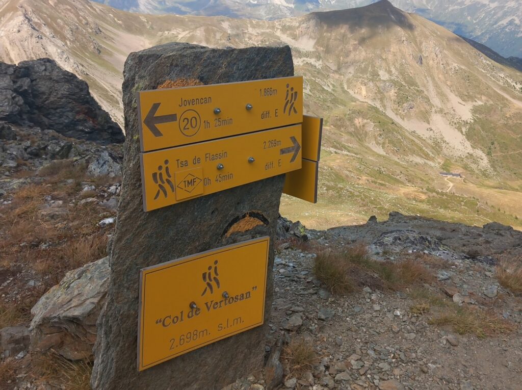
Take the path to the right, towards Tsa de Flassin. The first kilometer downhill is certainly a bit technical (but nothing difficult) and you have to be very careful not to slip on the stones in case of rain.
The descent then continues on a less stony and easier path up to Tsa de Flassin (2250 m a.s.l.).
Here the path ends and you take a wide mule track to the right.
The descent is quite long and after about 6 km along the Flassin valley it leads to the Saint Oyen campsite area.
Here you return to the woods and after a couple of kilometers of short ups and downs you return to the starting point.
In total, this third part is approx. 14 km with approx. 450 meters of elevation gain.
Additional information
If you want more information or technical details related to this route, please do not hesitate to contact me or comment below.
Other information about races, results and equipments at the following links: Trail & Running | EmigranTrailer.
Enjoy Hiking & Trail Running!
Andrea De Filippo
Original post in english language. For other languages, please open with a web browser (i.e. Chrome) and apply the automatic translation
You might find of interest other similar articles here: Exploring Routes | EmigranTrailer


